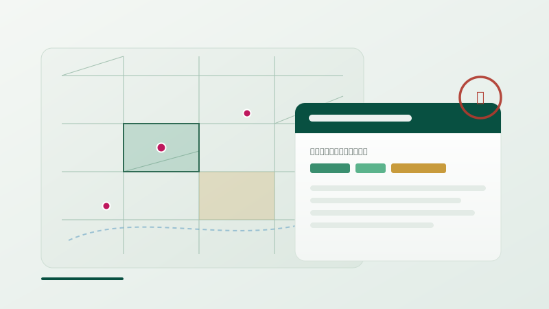
Three inefficiencies property professionals face
Evidence scattered across counters
Appraisal reports at MLIT, registry maps at the Legal Affairs Bureau, land prices at MLIT, hazards on municipal portals. Rotating between counters and hand-matching the data eats half a day to a full day per case.
Land-history research turns person-dependent
What was this land before — a wetland, reclaimed ground, a former riverbed? Checking old maps, historical topographic maps, and flood-control landform classifications is laborious and leans on individual experience.
No local knowledge for cross-area cases
For cases outside one's home turf, gathering land-price trends and comparables takes time. Handling all of Kyushu on one platform curbs variance in investigation quality.
What changes for desk research with MAPRISE
| Scenario | Before | After (MAPRISE) |
|---|---|---|
| Appraisal evidence | Manually gather reports / land prices / comparables (half a day+) | Appraisal-report layer + 19 years of land prices on one screen |
| Boundary pre-check | Obtain registry map, survey drawings, land history separately | Registry map, parcel polygons, and land history overlaid |
| Title / transaction DD | Investigate regulations, hazards, title separately (days) | Gather one property's data at once; grasp overall risk in minutes |
The Before / After above shows the workflow improvements MAPRISE aims to deliver (estimates); actual results vary by environment and usage.
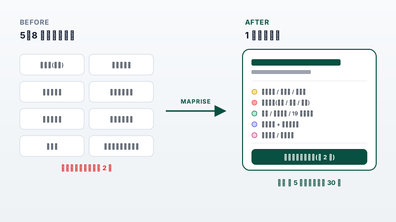
From rotating appraisal, registry, land-history, and hazard counters to a single MAPRISE screen
For real estate appraisers — appraisal reports as a map layer
Display appraisal report information for 2,388 standard points across 7 Kyushu prefectures (23,360 records) as map points; click to see comparison, income, and cost valuations in a popup. Because two independent appraisals per standard point are included, you can also check valuation objectivity. Nineteen years of land-price trends, surrounding comparables, and station-power vs. land-price analysis reinforce your evidence.
Few competing GIS tools in Japan offer appraisal reports in an integrated UI — this is a MAPRISE-specific value.
On-map display of appraisal report data is available as a beta. (AI integration and PDF output are planned for Phase 2.)
Note: the data is reference information and does not replace a formal appraisal.
For land & house surveyors — registry, boundaries, and land history on one screen
Check registry maps (~21.6M records) and parcel polygons on the map. Overlaying Meiji-era wetlands, historical topographic maps, and flood-control landform classifications lets you pre-investigate land formation and boundary changes at the desk, narrowing down before fieldwork and survey.
Note: this data has no certifying function at the Legal Affairs Bureau. It does not replace formal boundary determination or survey; please use it as an aid to preliminary investigation.
For judicial scriveners & lawyers — title DD, down to the geospatial layer
For settlement, inheritance, and dispute cases, grasp a property's regulations, hazards, land history, and surroundings in one pass. Generate an investigation report with an overall risk score and verdict in minutes, supporting due diligence that includes the geospatial information often outside your specialty.
Note: analysis results are reference information. Formal title confirmation requires obtaining a certified registry record.
Frequently asked questions
Q. Can a solo practice use it?
A. Yes. For professionals we recommend the Pro plan, suited to solo and small offices — AI chat, detailed reports (10/month), and your own logo.
Q. How reliable is the data?
A. We integrate public data from MLIT, the Legal Affairs Bureau, AIST, and others with sources cited. It is reference information, not a substitute for formal appraisal, survey, or title confirmation; each screen shows a disclaimer.
Q. Do you cover areas outside Kyushu?
A. We currently cover the 7 Kyushu prefectures. Coverage will expand over time.
Q. How about security?
A. Built on AWS with TLS encryption end-to-end. The property information you input is not shared with other users.
Recommended plan
For professionals' pre-investigation work, we recommend the Pro plan.
- AI-powered analysis and summaries
- 10 detailed reports per month
- Own-logo display (white label)
- Full layer access across Kyushu