We've added a new tool for measuring distance and area directly on the map. It's a standard feature in pretty much any GIS tool, which is exactly why we focused on making it something you can use without a moment's hesitation. Click the Measure button at the bottom of the screen, pick distance or area, and click your way across the map.
Hello from the MAPRISE team. This is a simple report: we've shipped a new tool for measuring distance and area directly on the map.
Measuring distance and area is, frankly, a basic feature that pretty much any GIS tool already has. There's nothing novel about it. That's exactly why, this time, we focused specifically on how effortlessly people could actually use it.
How it works
Just click the "Measure" button at the bottom of the screen, and measurement mode starts.

Clicking it brings up a toolbar. Choose "Distance" or "Area," then just click your way across the map.
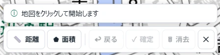
Measuring distance ― not just a straight line, but multi-segment paths too
Selecting "Distance" highlights that button in green.
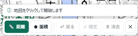
Clicking a series of points along a route lets you measure the total distance of a winding path — not just a single straight line.
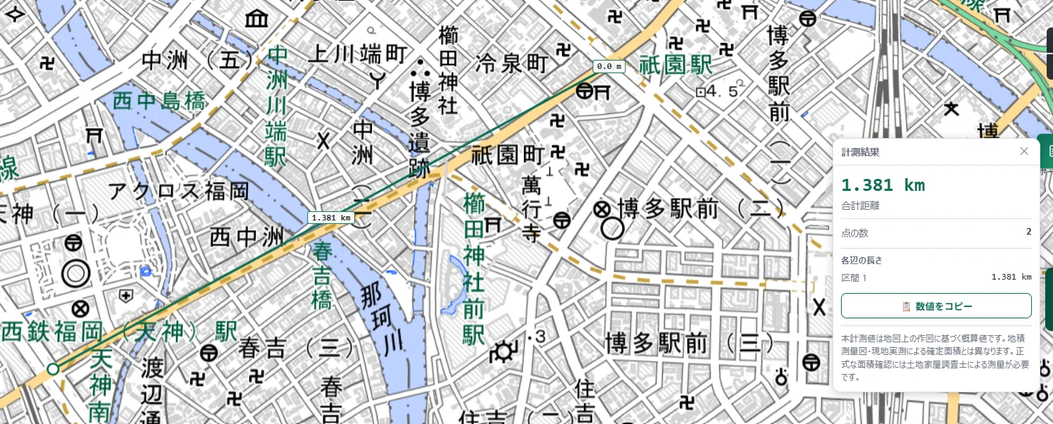
In the example above, we measured a route from Tenjin to Gion and got a total distance of 1.381 km. The results panel shows not just the total, but the length of each individual segment too, so you can look back later and see exactly how far it was between any two points along the route.
Measuring area ― complex, multi-vertex shapes included
Selecting "Area" switches the same toolbar into area mode.
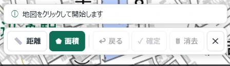
Rectangles are easy, of course, but even a complex shape with many corners — like a building's footprint — can be traced just by clicking each vertex in turn.
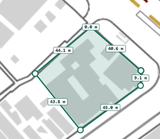
Once confirmed, the results panel shows the area, perimeter, and length of each edge all together. You can switch the unit between square meters, tsubo, and hectares.
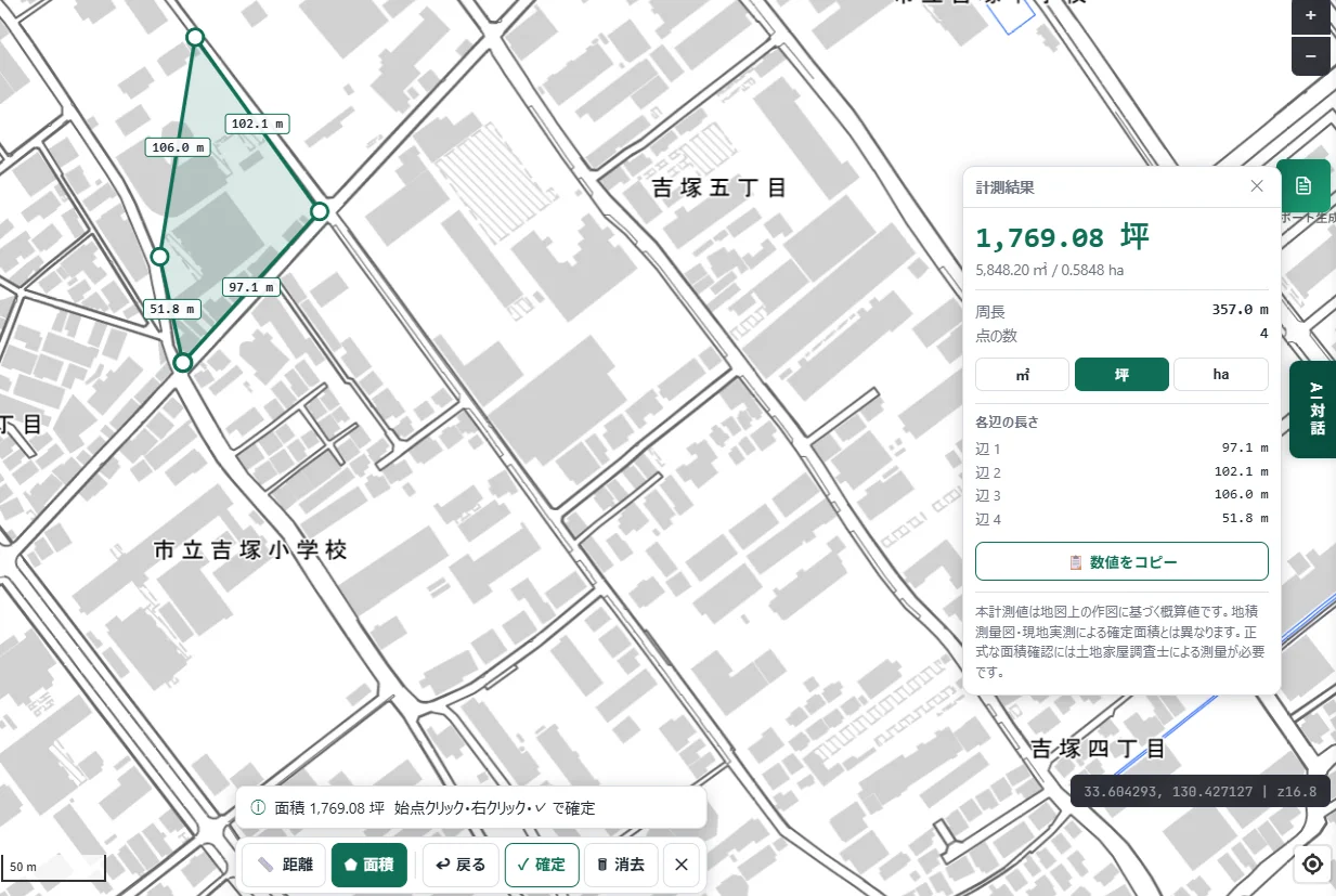
There's also a "Copy values" button, so you can paste the results straight into a document.
Why we cared this much about a "basic" feature
Measurement tools exist in most GIS products. But in practice, we've found that small frictions pile up fast — not knowing where the button is, not being sure how to switch between distance and area, having no way to undo a misplaced vertex — and before long, people just stop using the feature at all.
So this time, we paid attention to a few specific things:
- A single "Measure" button as the one entry point, so there's no ambiguity about where to start
- Switching between "Distance" and "Area" happens on the same toolbar, without leaving the flow
- The running distance or area updates in real time with every click
- "Undo" removes just the last vertex, and "Clear" resets everything, so mistakes are cheap to fix
- Area can be toggled between square meters, tsubo, and hectares, so you can convert straight into the unit your work actually uses
None of this is a flashy new capability. But we think it's exactly these basic features — the ones you reach for without thinking — where usability actually matters most in day-to-day work.
About the measured values
These measurements are estimates based on how the shape is drawn on the map. They differ from the confirmed area you'd get from an official land survey plot or an on-site survey — for a formal area confirmation, a licensed land and house surveyor's measurement is required. The same applies to distance: please treat it as an on-map estimate.
Closing
The measurement tool itself is nothing new. Even so, day-to-day work is full of moments where you just want to quickly check a distance, or get a rough sense of a plot's area. We'd be glad if this turns out to be something you can reach for in those moments without a second thought.
Questions or feedback are always welcome at info@maprise.jp.
Tags: #Measurement #UI/UX #Map interaction
Other-language share text (exception cases)
Quick share above follows our platform-locked language policy (X-family in Japanese, LinkedIn in English). The four panes below let you grab the opposite-language body when needed — e.g. introducing an English post to a Japanese audience on X, or posting a Japanese article to LinkedIn in Japanese. Each pane offers both a copy button and a direct intent link.
📝 距離と面積の計測を実装しました ― GISの基本機能ほど、使いやすさにこだわりたい
地図上で距離・面積を測る機能を新しく実装しました。GISツールであれば標準的に備えている、いわば基本機能です。だからこそ、迷わず使える操作にこだわりました。画面下の「計測」を押し、距離か面積かを選び、あとは地図をクリックしていくだけです。
https://maprise.jp/ja/blog/measure-distance-and-area/ #計測 #UI/UX
🆕 新しいブログ記事を公開しました。

《距離と面積の計測を実装しました ― GISの基本機能ほど、使いやすさにこだわりたい》

地図上で距離・面積を測る機能を新しく実装しました。GISツールであれば標準的に備えている、いわば基本機能です。だからこそ、迷わず使える操作にこだわりました。画面下の「計測」を押し、距離か面積かを選び、あとは地図をクリックしていくだけです。

👉 詳しくはこちら: https://maprise.jp/ja/blog/measure-distance-and-area/

#UI/UX
📝 We Added Distance and Area Measurement ― Basic GIS Features Deserve Just as Much Care
We've added a new tool for measuring distance and area directly on the map. It's a standard feature in pretty much any GIS tool, which is exact…
https://maprise.jp/en/blog/measure-distance-and-area/ #Measurement #UI/UX
🆕 New on the MAPRISE blog.

《We Added Distance and Area Measurement ― Basic GIS Features Deserve Just as Much Care》

We've added a new tool for measuring distance and area directly on the map. It's a standard feature in pretty much any GIS tool, which is exactly why we focused on making it something you can use without a moment's hesitation. Click the Measure button at the bottom of the screen, pick distance or area, and click your way across the map.

👉 Read the full post: https://maprise.jp/en/blog/measure-distance-and-area/

#Measurement #UI/UX #Mapinteraction
Related posts
- Map nerds start from an area. Real-estate pros start from a pin. The one comment from the field that kicked off a 3-day rebuild of address search2026-08-01
- We Mapped 2,966 Unused National-Owned Properties Nationwide2026-08-30
- From 7 prefectures in Kyushu to nationwide - a day spent checking data one sheet at a time2026-08-14