We've mapped Shinto shrines, Buddhist temples, Christian churches, mosques, and other religious facilities across all 47 prefectures. Here's the data source breakdown, how we grouped the five categories, what you can see by clicking a point, and — honestly — why the map looks different from region to region.
Hello from the MAPRISE team. This time we're introducing a "religious facilities" layer showing the locations of Shinto shrines, Buddhist temples, Christian churches, mosques, and other religious facilities.
Being upfront about the data
Let's start with exactly what this layer contains.
- Shrines, temples, and Christian churches: roughly 92,500 facilities across all 47 prefectures (as of September 2026).
- Data source breakdown: Fukuoka, Kumamoto, Hokkaido, and Akita combine OpenStreetMap with each prefecture's published "religious corporation registry" (CC BY-family license). Yamanashi combines OpenStreetMap with the same registry's 2019 data (we use that older edition because the current edition carries no license notice). Every other prefecture is based on OpenStreetMap alone.
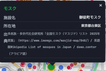
- Mosques: 164 nationwide, regardless of prefecture. Since no comprehensive government dataset exists, this is the result of individual research cross-referencing the Institute for Multiethnic and Multigenerational Societies' "List of Mosques in Japan," the English Wikipedia's "List of mosques in Japan," and several community sources.
- Layer ID:
religious_facilities - Reflected in MAPRISE as of: September 24, 2026 (updated on an irregular schedule)
Five categories — Shinto, Buddhism, Christianity, Islam, and everything else
The legend has five categories.
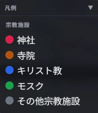
- Shrine (Shinto): red
- Temple (Buddhism): orange
- Christian: blue
- Mosque (Islam): green
- Other religious facility: gray
Buddhism, Christianity, and Islam each have numerous denominations and sects, but MAPRISE groups them simply as "Temple," "Christian," and "Mosque." Anything that doesn't fall into one of these four categories is grouped together as "Other religious facility." Japan is home to a large number of registered religious corporations and facilities — Sect Shinto groups and new religious movements among them — that don't fit neatly into shrine, temple, church, or mosque, and this category captures all of them together.
What clicking tells you
Clicking a point on the map shows the facility name, address, and source in a popup.
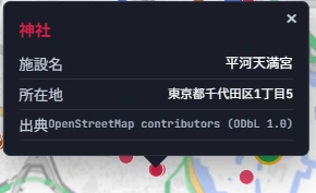
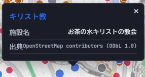
The mosque popup shows a more detailed source, reflecting the individual research behind it.
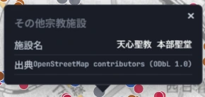
The example shown for "other religious facility" is the head sanctuary of Tenshin Seikyo, a registered Japanese religious corporation. As this shows, there's a real and diverse range of places of worship on the map that simply don't fit within the shrine / temple / church / mosque framework.
Try it: Kyushu and Shikoku
Here's what it looks like when you display the Kyushu and Shikoku regions in MAPRISE.
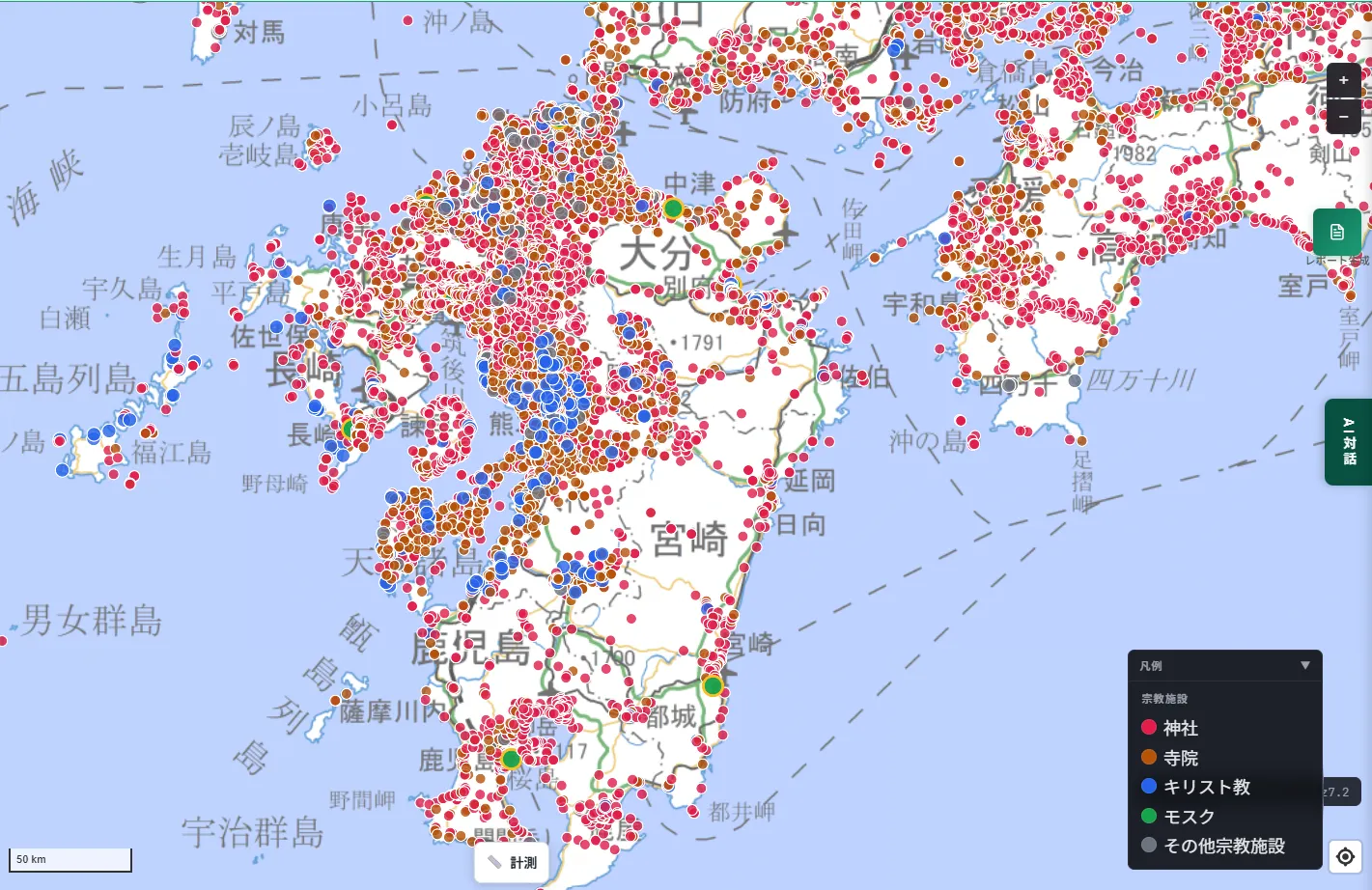
You can see a dense cluster of Christian churches (blue) spanning Nagasaki Prefecture and the Amakusa region of Kumamoto Prefecture. This area overlaps with the "Hidden Christian Sites in the Nagasaki Region," inscribed as a UNESCO World Heritage Site in 2018 for its history of people secretly passing down their faith under the Edo-period ban on Christianity.
Try it: Kinki
Here's what it looks like across the Kinki region.
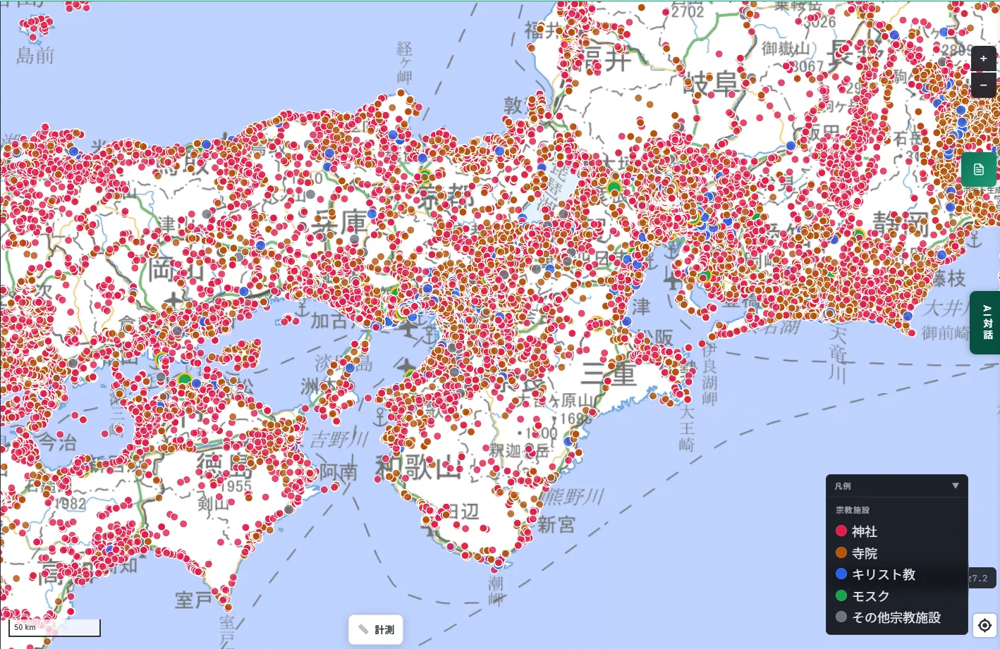
Centered on Kyoto and Nara, shrines and temples appear at an extremely high density — a reflection, it seems, of centuries of accumulated history in Japan's ancient capital region.
Try it: Kanto and Chubu
Here's what it looks like across the Kanto and Chubu regions.
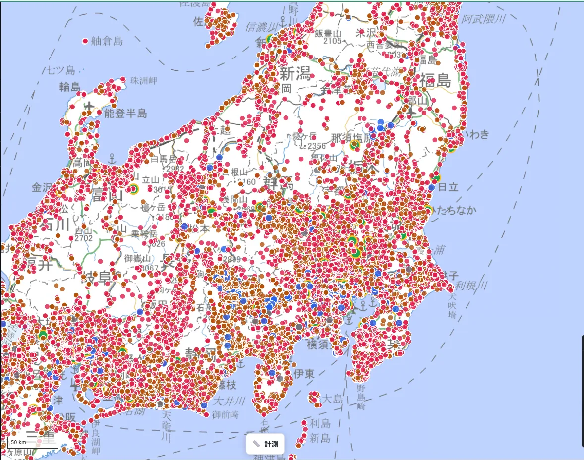
Across the greater Tokyo area and into the Chubu region, shrines and temples again make up the bulk of the numerous religious facilities shown.
Try it: Tohoku
Here's what it looks like across the Tohoku region.
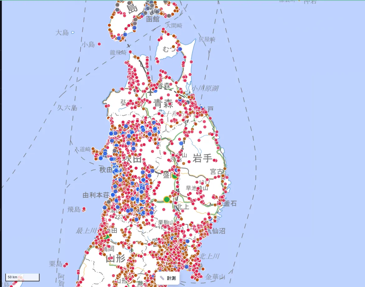
Akita Prefecture appears to have a dense cluster of Christian churches (blue), but this is heavily influenced by the fact that Akita is one of the four prefectures where we've merged in the religious corporation registry. As we explain in more detail below, this most likely reflects more thorough data coverage for churches than the other 43 prefectures get — not necessarily a direct picture of the actual distribution of faith communities.
Try it: Hokkaido
Here's what it looks like across Hokkaido.
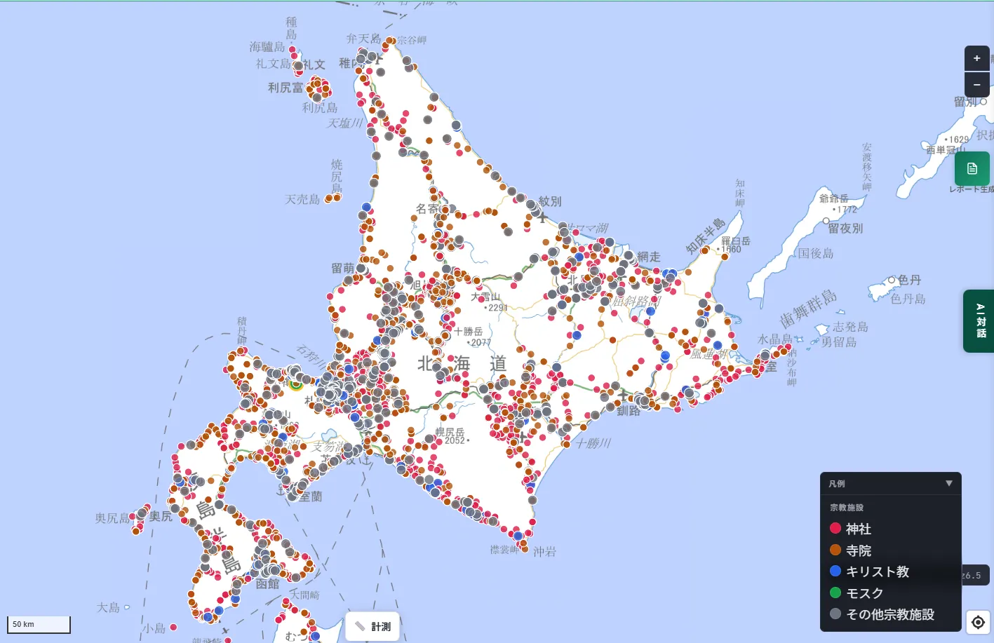
What stands out is the extremely high density of "other religious facilities" (gray) across all of Hokkaido. As with the Tohoku example, this is largely because Hokkaido is one of the four prefectures where we've merged in the religious corporation registry.
Being upfront about why the map looks different from region to region
As you've seen, Fukuoka, Kumamoto, Hokkaido, and Akita all show noticeably more Christian churches and other religious facilities than other prefectures. That's because these four prefectures are the only ones where we've merged OpenStreetMap with the prefecture's religious corporation registry. That registry includes many smaller churches, Sect Shinto groups, and new religious movements that aren't registered in OpenStreetMap, and merging it in brings them onto the map.
In other words, the fact that these four prefectures show more facilities reflects, to a significant degree, better data coverage — not necessarily that these regions genuinely have more religious facilities than anywhere else. It's likely that many unregistered churches and other religious facilities exist in the remaining 43 prefectures too, simply not captured in OpenStreetMap.
Being upfront about the data's limits
If a shrine or temple you know exists doesn't appear on the map, it's most likely because it isn't registered in OpenStreetMap, or because the prefecture hasn't published its religious corporation registry as open data. This layer doesn't comprehensively cover every religious facility in Japan — coverage depends on how complete the underlying data sources are.
The same applies to mosques: since no comprehensive government dataset exists, we rely on academic research and multiple cross-referenced sources. Mosques opened or closed after the research was conducted may not be reflected.
Where this comes in handy
- Regional and local history: a way to learn what kinds of faith communities have taken root in your area, or in a place you're curious about.
- Multicultural coexistence and urban planning: useful reference information for local governments working on multicultural coexistence policy or urban planning that accounts for a region's religious and cultural background.
- Local history research: a way to check the distribution of nearby religious facilities as part of site selection or area research.
- Travel and relocation: a way to get a feel for a region's cultural character when considering a trip or a move.
Closing
Japan is a country of Shinto, home to countless kami, yet also home to a living, breathing diversity of faith — Buddhism brought from the continent, and later Christianity and Islam, each with facilities scattered across the country. What this layer makes newly visible is just how many religious facilities fall outside all four of those categories — shrine, temple, church, mosque — grouped here as "other." The countless points on the map turn religious and cultural diversity into something you can see as actual places, not just a number. We hope this proves useful as one more lens for site research and understanding a region.
Questions or feedback are always welcome at info@maprise.jp.
The religious facilities data introduced in this post is reference information built from OpenStreetMap (ODbL 1.0), the religious corporation registries published by Fukuoka, Kumamoto, Hokkaido, Akita, and Yamanashi prefectures (CC BY-family license; Yamanashi's data is from 2019), and individual research on mosques (the Institute for Multiethnic and Multigenerational Societies' "List of Mosques in Japan," the English Wikipedia's "List of mosques in Japan," and several community sources). Fukuoka, Kumamoto, Hokkaido, and Akita may show more detailed coverage than other prefectures because their registries have been merged in. Facilities not present in these data sources will not appear. Please contact the facility or religious corporation directly for the most current information.
Tags: #Religious facilities #Open data #Regional understanding #Nationwide #Local history
Other-language share text (exception cases)
Quick share above follows our platform-locked language policy (X-family in Japanese, LinkedIn in English). The four panes below let you grab the opposite-language body when needed — e.g. introducing an English post to a Japanese audience on X, or posting a Japanese article to LinkedIn in Japanese. Each pane offers both a copy button and a direct intent link.
📝 宗教施設を地図にしました ― 神社・寺院・教会・モスクから『その他宗教施設』まで
神社・寺院・キリスト教会・モスク・その他宗教施設の所在地を、全国47都道府県で地図レイヤーとして実装しました。データソースの内訳、5つの分類の考え方、クリックで分かる詳細情報、そして地域による見え方の違いについて紹介します。
https://maprise.jp/ja/blog/religious-facilities/ #宗教施設 #オープンデータ
🆕 新しいブログ記事を公開しました。

《宗教施設を地図にしました ― 神社・寺院・教会・モスクから『その他宗教施設』まで》

神社・寺院・キリスト教会・モスク・その他宗教施設の所在地を、全国47都道府県で地図レイヤーとして実装しました。データソースの内訳、5つの分類の考え方、クリックで分かる詳細情報、そして地域による見え方の違いについて紹介します。

👉 詳しくはこちら: https://maprise.jp/ja/blog/religious-facilities/
📝 Religious Facilities, Mapped — From Shrines, Temples, and Churches to Mosques and 'Other Religious Facilities'
We've mapped Shinto shrines, Buddhist temples, Christian churches, mosques, and other religious facilities …
https://maprise.jp/en/blog/religious-facilities/ #Religiousfacilities #Opendata
🆕 New on the MAPRISE blog.

《Religious Facilities, Mapped — From Shrines, Temples, and Churches to Mosques and 'Other Religious Facilities'》

We've mapped Shinto shrines, Buddhist temples, Christian churches, mosques, and other religious facilities across all 47 prefectures. Here's the data source breakdown, how we grouped the five categories, what you can see by clicking a point, and — honestly — why the map looks different from region to region.

👉 Read the full post: https://maprise.jp/en/blog/religious-facilities/

#Religiousfacilities #Opendata #Regionalunderstanding #Nationwide #Localhistory