We've published a layer that color-codes the water utility serving each municipality in Japan and shows its contact desk. Here is how it looks in five regions from Hokkaido to Okinawa, and what you see when you click for the contact details.
Hello from the MAPRISE team.
When you move or build a home, have you ever wondered whom to contact to start your water service? Depending on the area, water is supplied by a city waterworks bureau, by a joint authority run by several municipalities, or by the prefecture.
So we've published a layer, "Water Utility Provider (Beta)", that color-codes the water utility and contact desk of each municipality on the map. It covers all 47 prefectures and about 1,700 municipalities. You can switch it on and off from the "Living Facilities / School Districts" group in the map app.
Municipalities in the same color are served by the same utility. Wide-area utilities (joint authorities, prefectural utilities and so on) are drawn slightly darker, and single-municipality utilities slightly lighter.
Hokkaido
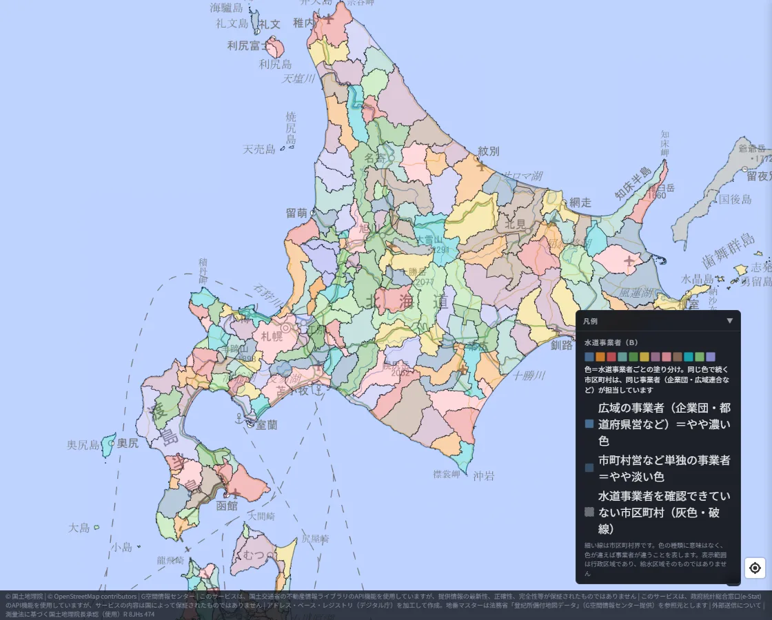
The colors are split finely, municipality by municipality. It suggests that in wide Hokkaido, many towns and villages run their own water supply.
Kanto
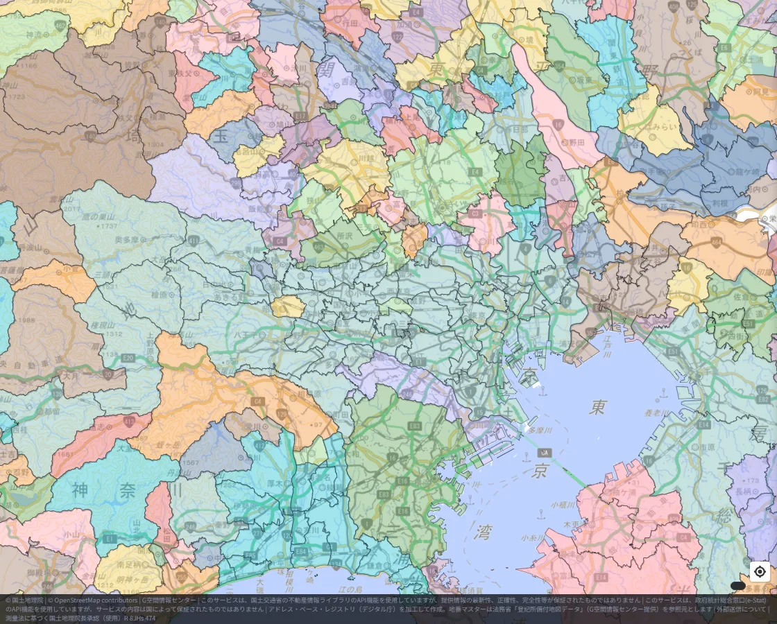
A wide area of Tokyo shares one color. In the surrounding prefectures, the colors of city utilities and joint authorities interlock.
Kansai
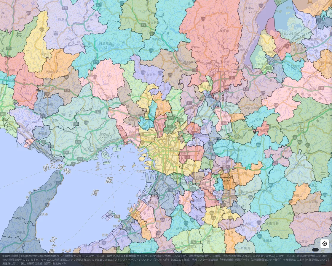
Many colors are mixed across Osaka, Hyogo and Kyoto. In some places the same utility's color continues across a prefectural border.
Kyushu
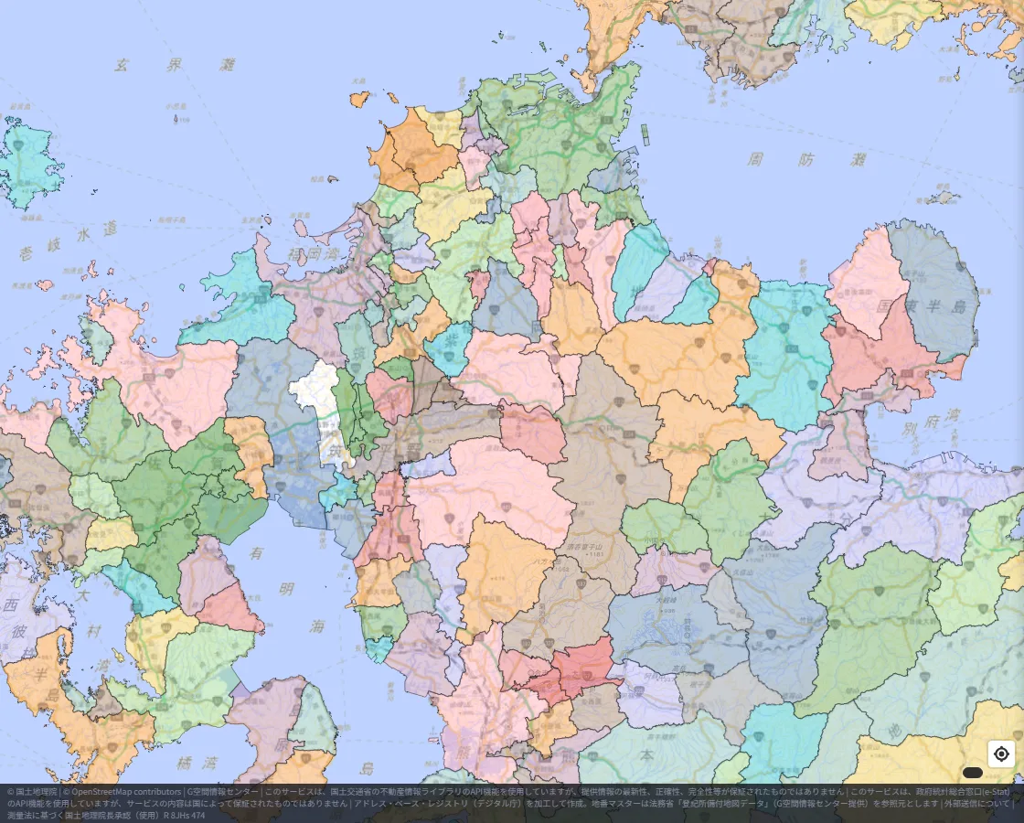
Centered on Fukuoka Prefecture, areas of a single color spanning several municipalities (joint authorities and the like) sit next to city utilities.
Okinawa
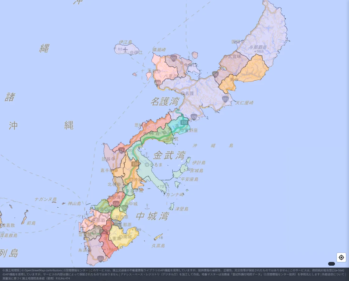
In the north of the main island, a wide area shares one color, while the central and southern parts are split finely by municipality.
Click to see the contact desk
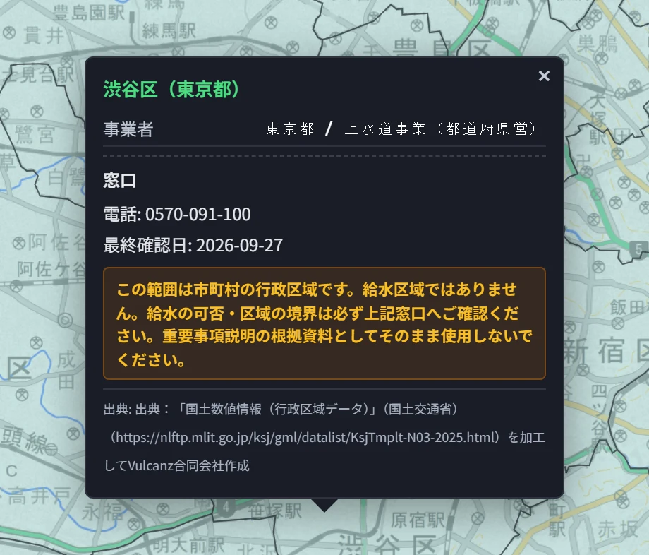
Click a municipality to see the utility name, the type of business, the contact desk and the last-verified date.
First, an example in Tokyo (Shibuya Ward). The utility is the Tokyo Metropolis, and the desk's phone number is shown.
Next, a joint authority (Tagawa City, Fukuoka). The department, phone, address and URL are all shown.
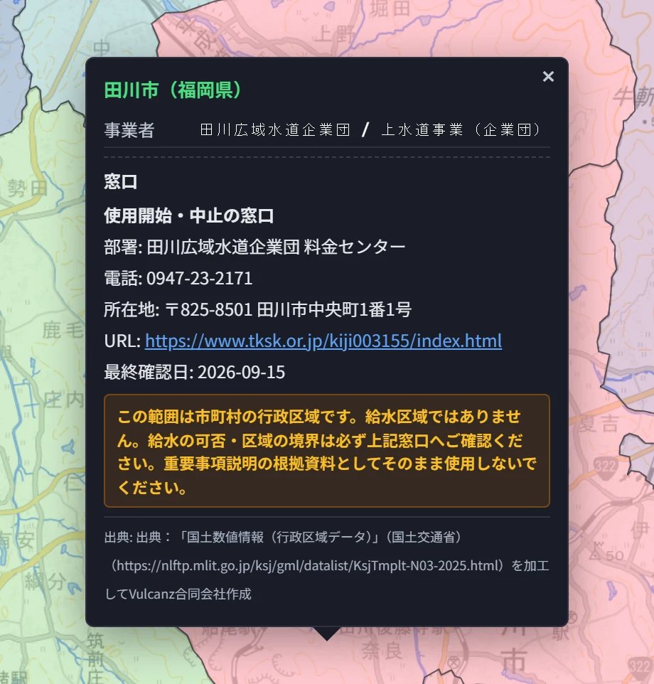
What is listed varies by utility. Some show only a phone number; others also show the department, address and URL.
When it helps
- Finding whom to call to start water service when you move or build
- Checking before buying land or a house whether the area has public water (it might be on a well or a simplified water system)
- Finding which utility is in charge of a property that spans several municipalities
In our September post we said we could not put water pipe information on the map. This time, instead of pipe locations, we narrowed it down to "which utility's desk to ask".
Please note
- The area shown is the administrative area of each municipality, not the actual service area (where the pipes reach).
- Always confirm directly with the listed desk whether service and connection work are possible.
- Contact details are researched from each utility's published materials and updated continuously, but they may differ from the latest information.
- This layer is provided as a beta.
If you have comments or questions, please write to info@maprise.jp.
The water utility data in this post is reference information researched and processed by Vulcanz LLC from the materials published by each water utility. Municipal shapes are processed from the National Land Numerical Information (administrative areas), used with the approval of the Director-General of the Geospatial Information Authority of Japan under the Survey Act (approval no. R 8JHs 474). Background maps are provided by the Geospatial Information Authority of Japan.
Tags: #Water utilities #Water supply #Contact desk #Moving #New construction #Water connection work
Other-language share text (exception cases)
Quick share above follows our platform-locked language policy (X-family in Japanese, LinkedIn in English). The four panes below let you grab the opposite-language body when needed — e.g. introducing an English post to a Japanese audience on X, or posting a Japanese article to LinkedIn in Japanese. Each pane offers both a copy button and a direct intent link.
📝 水道事業者の地図を公開しました ― 引越し・新築の前に、どこへ連絡すればいいかが地図で分かります
全国の市区町村ごとの水道事業者(水道局・企業団など)と問い合わせ窓口を、色分けして地図に表示するレイヤーを公開しました。北海道から沖縄まで5つの地域の見え方と、クリックしたときの連絡先の表示を紹介します。
https://maprise.jp/ja/blog/water-service-area/ #水道事業者 #水道
🆕 新しいブログ記事を公開しました。

《水道事業者の地図を公開しました ― 引越し・新築の前に、どこへ連絡すればいいかが地図で分かります》

全国の市区町村ごとの水道事業者(水道局・企業団など)と問い合わせ窓口を、色分けして地図に表示するレイヤーを公開しました。北海道から沖縄まで5つの地域の見え方と、クリックしたときの連絡先の表示を紹介します。

👉 詳しくはこちら: https://maprise.jp/ja/blog/water-service-area/
📝 A Map of Water Utilities Is Now Live — Find Out Whom to Contact Before You Move or Build
We've published a layer that color-codes the water utility serving each municipality in Japan and shows its contact desk. Here is h…
https://maprise.jp/en/blog/water-service-area/ #Waterutilities #Watersupply
🆕 New on the MAPRISE blog.

《A Map of Water Utilities Is Now Live — Find Out Whom to Contact Before You Move or Build》

We've published a layer that color-codes the water utility serving each municipality in Japan and shows its contact desk. Here is how it looks in five regions from Hokkaido to Okinawa, and what you see when you click for the contact details.

👉 Read the full post: https://maprise.jp/en/blog/water-service-area/

#Waterutilities #Watersupply #Contactdesk #Moving #Newconstruction
Related posts
- Where Do Airplanes Actually Fly? Haneda, Narita, Kansai, Itami and Fukuoka on the Aircraft Overflight Layer2026-10-21
- How Do Airports on the Sea Look on a Map? Kansai and Centrair on the Aircraft Overflight Layer2026-10-21
- Nagasaki Station at 1 m: What a Hillside City Really Looks Like ― Colored Contour Maps Built from Nagasaki Prefecture's Point Cloud2026-10-21