The Kirameki-dori underground passage, which leads from the Tenjin underground mall toward Iwataya, has a strange bridge-like structure. A hunch and MAPRISE's old-map layers revealed that the Hizen Moat once flowed right beneath it.
Even on a route you've walked many times, you sometimes stop in your tracks without quite knowing why. This post started with one of those detours.
I stopped walking in Tenjin
The "Kirameki-dori underground passage" links the Tenjin underground mall with the Tenjin Nishi-dori area and the Iwataya main store. Most people pass through it on the way to shopping or a meeting, without giving it a second thought.
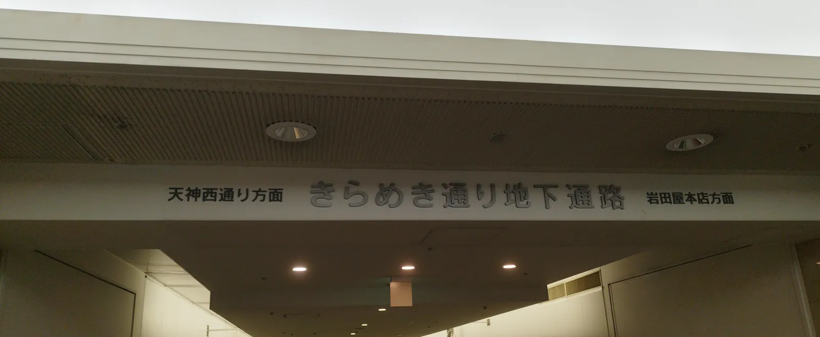
But look closely and this passage is a little odd. Slanted metal pylons stand against the walls, with cables fanning out from them across the white surface. Along the edge runs a handrail that looks like the railing of a bridge.
An underground "suspension bridge," in photos
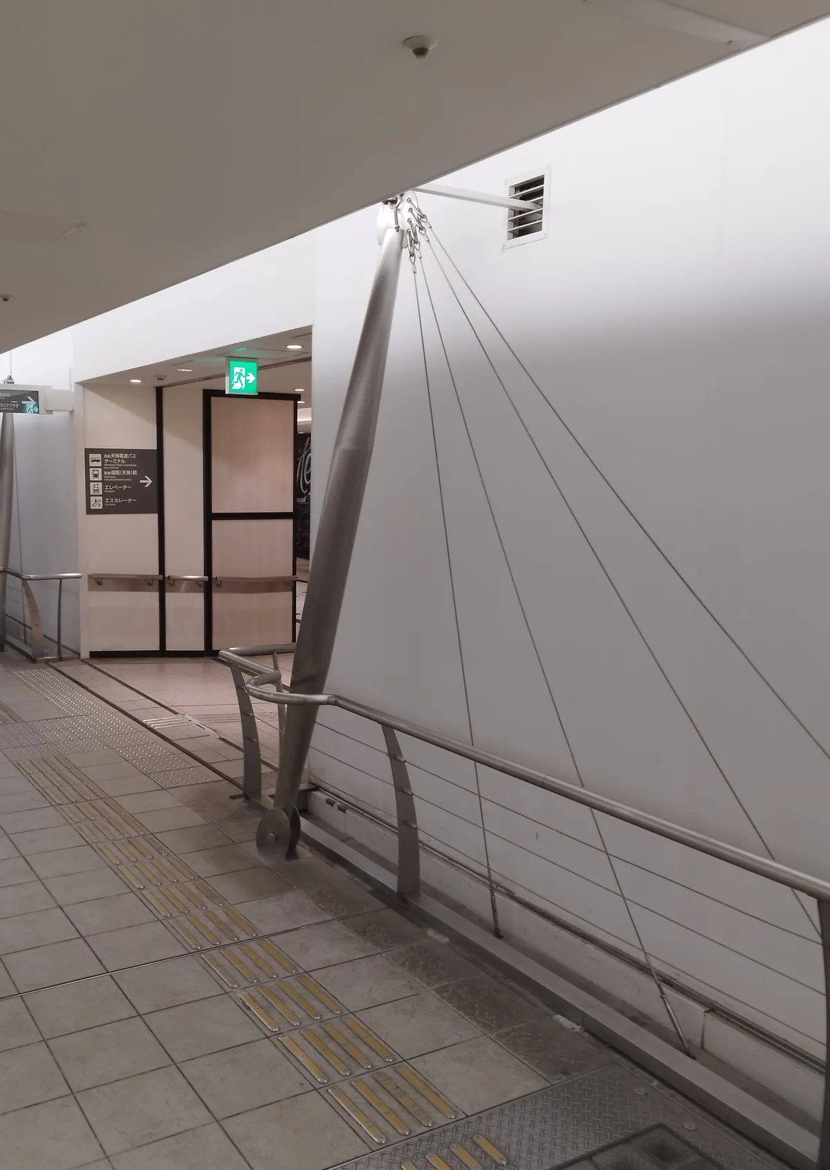
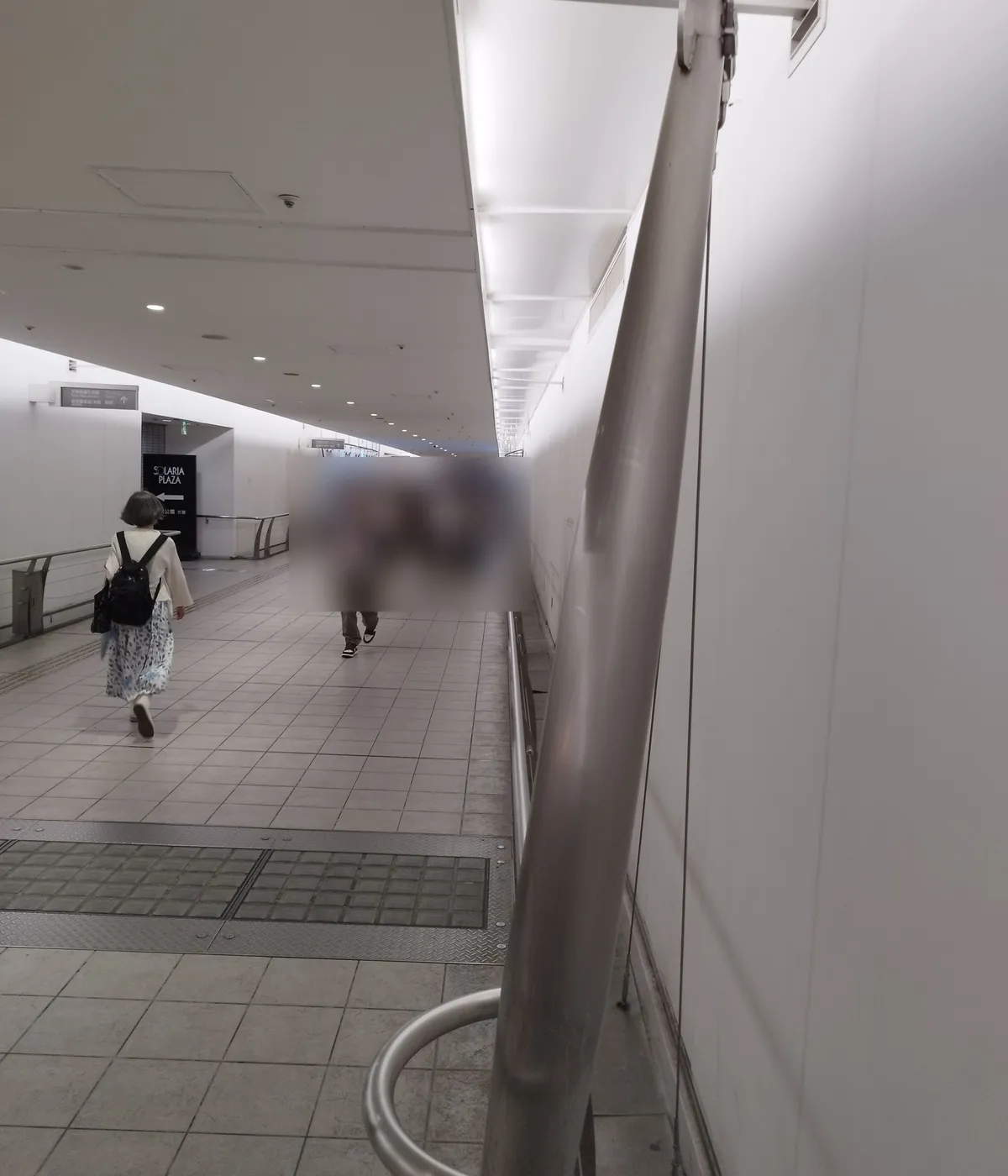
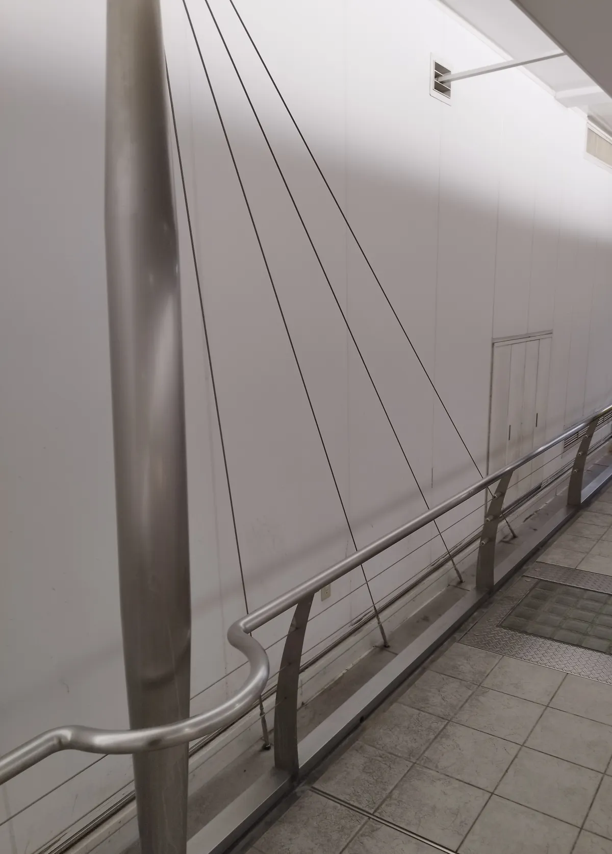
It may be closer to a cable-stayed bridge than a suspension bridge, with its slanted pylons and cables. Either way, I wondered why a plain underground passage needed such a bridge-like design. Honestly, my first reaction was: "What an elaborate, pointless ornament."
The passage runs east to west. That "east-west bridge" shape kept nagging at me.
"Why a bridge here?" — I opened the map
So I looked at the same place in MAPRISE's old-map layers, using the "Meiji-era wetlands" layer, which is built from the Geospatial Information Authority of Japan's Meiji-era old maps.
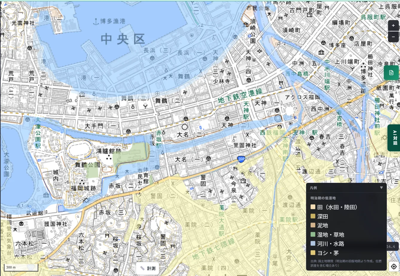
A light-blue band stretches east from the moats around the Fukuoka Castle site, cutting across Tenjin. In the legend, light blue means "rivers and waterways." Let's zoom into the area around Tenjin 2-chome.
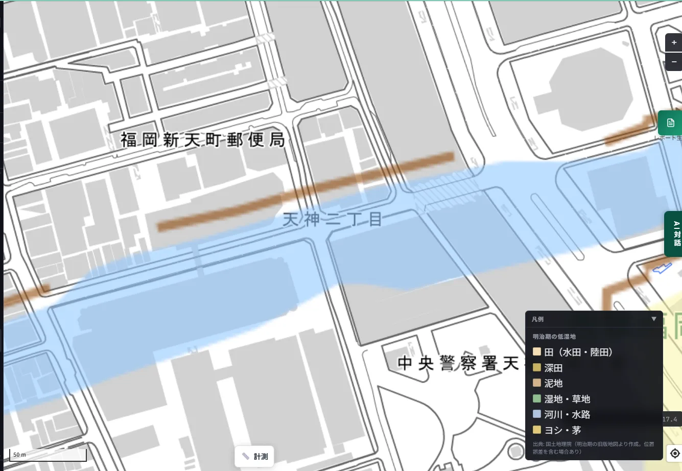
The light-blue band runs east to west regardless of today's roads and building blocks. The map makes it clear that the area around Tenjin 2-chome, where Kirameki-dori lies, was once a path for water.
The Hizen Moat once flowed beneath our feet
That light-blue band is the "Hizen Moat" I wrote about in an earlier article: a roughly 50-meter-wide moat built along with Fukuoka Castle, which once cut through the heart of Tenjin from east to west. It was filled in in 1910 (Meiji 43), and the ground is now roads and buildings.
In other words, there was once a large east-west moat right under the Kirameki-dori underground passage. And the passage still crosses that moat's route today.
Is the "bridge" a memory of the bridge that crossed the moat?
From here on, it's my own speculation. I haven't been able to find any documents that explain the design intent behind this passage.
Still, a bridge-like passage sits where a bridge over a moat would have been, and it runs in the same east-west direction as the moat. It seems a shame to dismiss that as pure coincidence. I imagine this seemingly pointless ornament might be a way of evoking, even slightly, the old scenery of the moat and its bridge.
At the end of the passage there's also a wall of rounded stones stacked together.
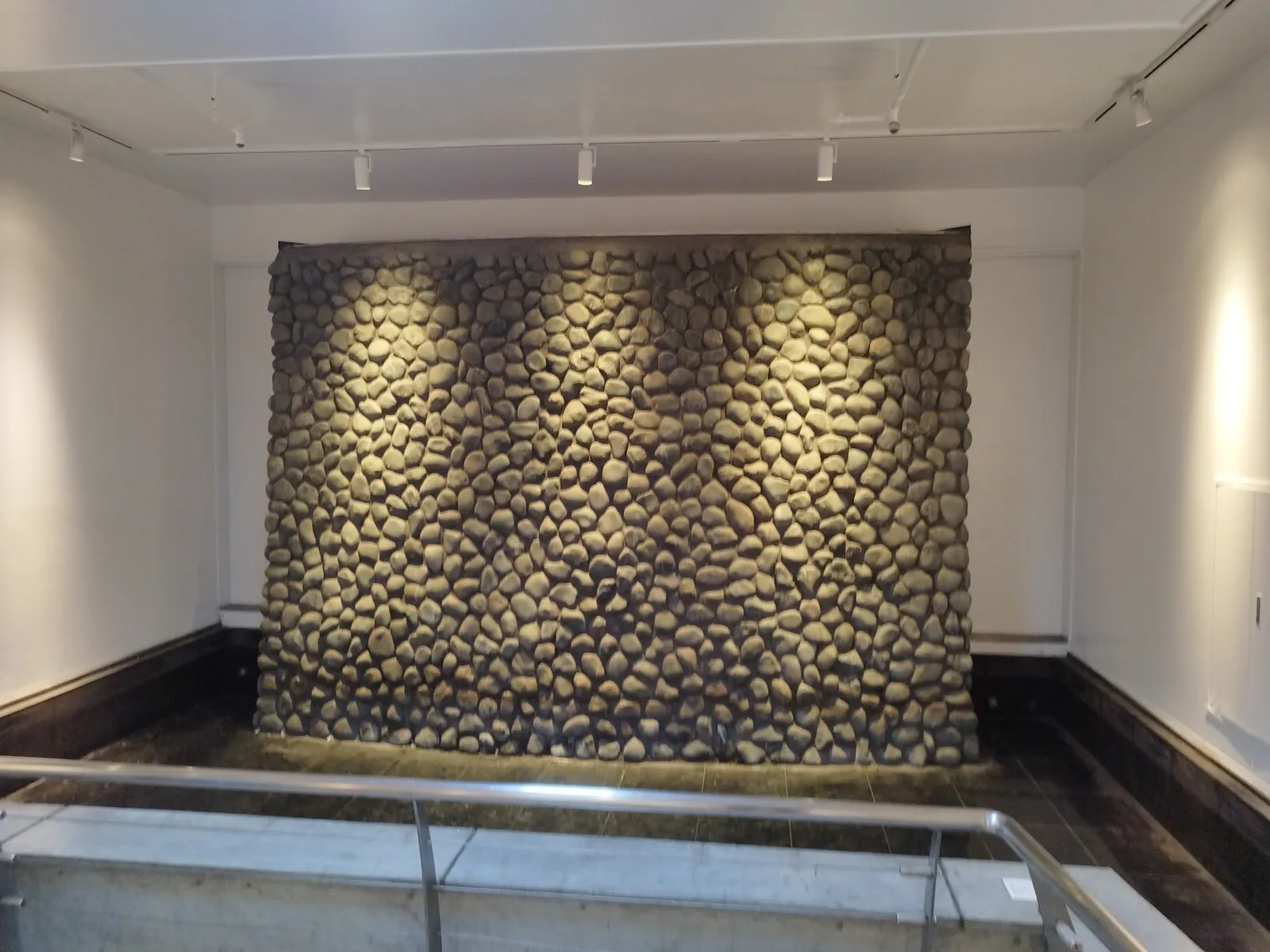
If it was a moat, its banks would have been faced with stone. This stonework may be meant to echo the moat's stone walls. That said, I haven't been able to confirm on site whether it's an actual relic or a design element.
Overlay a map, and ordinary scenery starts to make sense
What this episode showed me is that laying a single map over a place can give a reason to scenery I'd been walking past without noticing.
MAPRISE's old-map layers aren't only for this kind of historical fun. Places that were once rivers, waterways, or wetlands tend to have softer ground, which can be a clue when thinking about liquefaction during earthquakes. I find it interesting that the same layer can serve both a small curiosity on a city walk and practical work on understanding the land.
Closing
Looking at this stone wall, something suddenly came back to me. Come to think of it, the Tenjin underground mall also has a plaza of stonework that evokes a moat's stone walls. I once researched it and wrote an article about it, and rereading it now, I notice that the same story of the Hizen Moat connects the two places.
I wrote about the "stone-paved plaza" and the Hizen Moat in the Tenjin underground mall in this article. Read together, I think this "bridge" story feels a little more three-dimensional.
The historical background of the Hizen Moat in this article is based on information published by the City of Fukuoka and the on-site information board at the "Stone-Paved Plaza" in the Tenjin underground mall. We have not been able to confirm the design intent of the Kirameki-dori underground passage, and the related statements in the text are my own speculation. The old-map layer (Meiji-era wetlands) is reference information built from the Geospatial Information Authority of Japan's Meiji-era old maps and may contain positional errors. I took the photographs on site; people appearing in them have been processed so they cannot be identified.
Sources: Geospatial Information Authority of Japan (Meiji-era old maps); City of Fukuoka, "Hizen Moat and the Stone-Paved Plaza"
Tags: #Tenjin underground mall #Kirameki-dori #Hizen Moat #Old maps #Fukuoka Castle
Other-language share text (exception cases)
Quick share above follows our platform-locked language policy (X-family in Japanese, LinkedIn in English). The four panes below let you grab the opposite-language body when needed — e.g. introducing an English post to a Japanese audience on X, or posting a Japanese article to LinkedIn in Japanese. Each pane offers both a copy button and a direct intent link.
📝 天神の地下通路に、なぜ「吊り橋」があるのか ― 古地図レイヤーで見えた肥前堀との意外な接点
天神地下街から岩田屋方面へ抜けるきらめき通り地下通路には、なぜか吊り橋のような造形があります。ふとした疑問からMAPRISEの古地図レイヤーを開くと、その足元にかつて肥前堀が流れていたことが見えてきました。
https://maprise.jp/ja/blog/tenjin-kirameki-bridge/ #天神地下街 #きらめき通り
🆕 新しいブログ記事を公開しました。

《天神の地下通路に、なぜ「吊り橋」があるのか ― 古地図レイヤーで見えた肥前堀との意外な接点》

天神地下街から岩田屋方面へ抜けるきらめき通り地下通路には、なぜか吊り橋のような造形があります。ふとした疑問からMAPRISEの古地図レイヤーを開くと、その足元にかつて肥前堀が流れていたことが見えてきました。

👉 詳しくはこちら: https://maprise.jp/ja/blog/tenjin-kirameki-bridge/
📝 Why Is There a "Suspension Bridge" in an Underground Passage in Tenjin? — An Unexpected Link to the Hizen Moat, Found with Old-Map Layers
The Kirameki-dori underground passage, which leads from the Tenjin underg…
https://maprise.jp/en/blog/tenjin-kirameki-bridge/ #Tenjinundergroundmall #Kirameki-dori
🆕 New on the MAPRISE blog.

《Why Is There a "Suspension Bridge" in an Underground Passage in Tenjin? — An Unexpected Link to the Hizen Moat, Found with Old-Map Layers》

The Kirameki-dori underground passage, which leads from the Tenjin underground mall toward Iwataya, has a strange bridge-like structure. A hunch and MAPRISE's old-map layers revealed that the Hizen Moat once flowed right beneath it.

👉 Read the full post: https://maprise.jp/en/blog/tenjin-kirameki-bridge/

#Tenjinundergroundmall #Kirameki-dori #HizenMoat #Oldmaps #FukuokaCastle
Related posts
- Chasing the Hizen Moat sleeping beneath Tenjin, with MAPRISE's old-map layers2026-07-11
- Don't Choose a Cliff-Top Home on View and Elevation Alone: Retaining Walls, Disclosure Rules, Land Prices and Yellow Zones, City by City (Part 2)2026-10-25
- Did the Rich Move Uphill to Avoid Floods? Testing 'Yamanote vs Shitamachi' in Tokyo, Nagoya, Osaka and Fukuoka with Four Maps2026-10-24