We've added a map layer that shows former railway lines and stations across Japan, year by year. Here's how it differs from our existing railway layer, how former stations are plotted, what you see when you click, and examples from Hokkaido to Kyushu, compared with past aerial photographs.
Hello from the MAPRISE team.
Land where trains once ran turns into roads and fields. A building that was once a station finds a new use. Over time, it all slowly fades. This time we're introducing a layer that keeps that "former railway" on the map: former railway lines and former stations.
Being upfront about the data
- Scale: roughly 6,000 line sections and about 2,900 former stations nationwide (as listed on our data sources page).
- Sources: line shapes come from OpenStreetMap (ODbL 1.0), and former-station locations and years come from Wikidata (CC0) and other sources, processed by Vulcanz LLC.
- Years: opening and closing years include estimates, taken from date tags in OpenStreetMap or from the years of nearby former stations (Wikidata). Some sections have no year at all.
- Accuracy: we don't guarantee the exact position of a former track bed or the current condition on the ground.
You can switch it on and off from "Railway Heritage (Closed Lines)" in the "Living Facilities / School Districts" group of the map app.
Former stations across Japan
First, here's all of Japan.
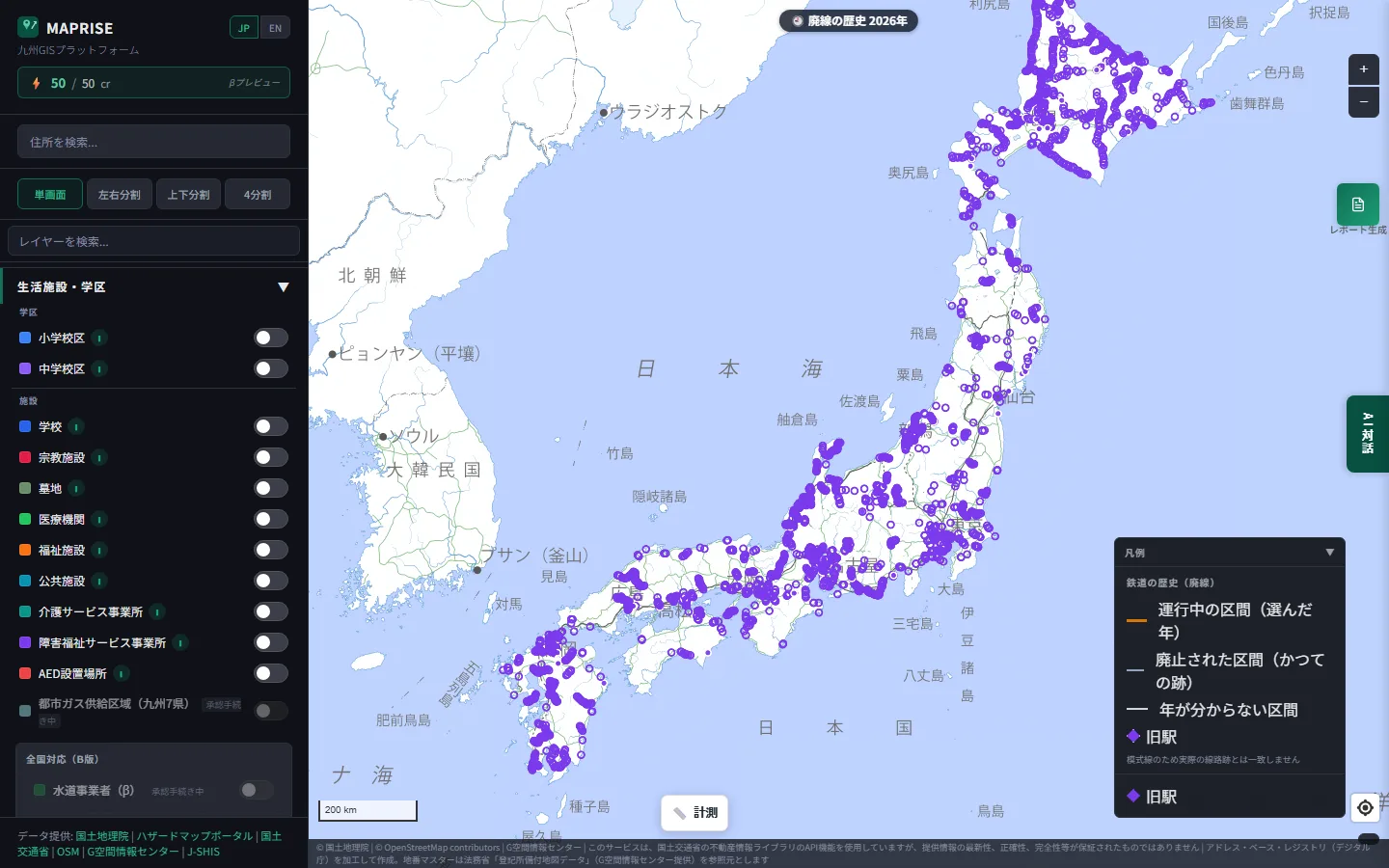
Former stations are scattered from Hokkaido to Kyushu. Hokkaido stands out, with dots lined up densely.
How it differs from the existing railway layer
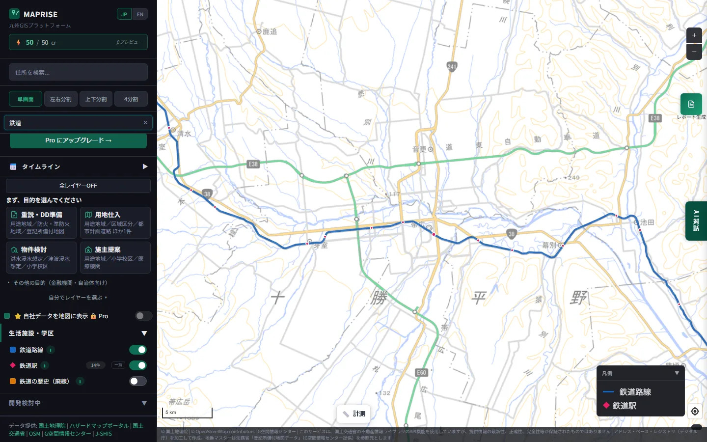
MAPRISE already has a layer for present-day railway lines and stations. Let's compare the two in the same place: the Tokachi region of Hokkaido, around Obihiro.
First, only the existing railway layer. The blue line is the current railway, and the red dots are stations.
Now we overlay "Railway Heritage (Closed Lines)" and set the year to 1960. The picture changes completely.
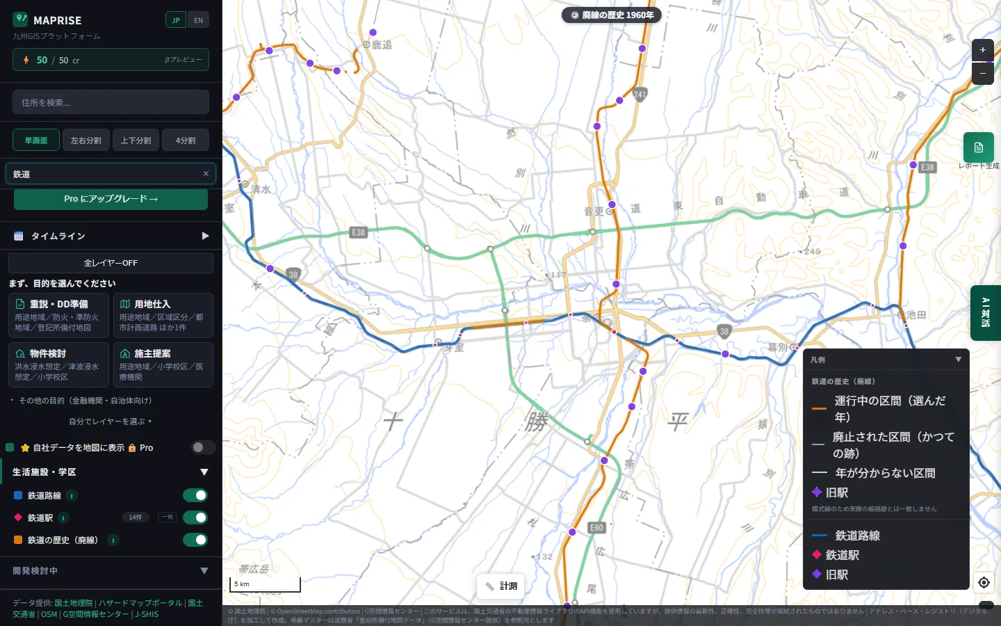
Orange means "a section that was running in the selected year." In 1960, lines that no longer exist ran north (the Shihoro Line) and south (the Hiroo Line) from Obihiro.
You can move the year anywhere from 1870 to 2026. Sections running in the selected year are orange, and closed sections are gray; as time moves forward, orange turns to gray. Color coding applies to sections whose closing year is known from the data; sections with no known year are shown in a separate, lighter gray.
How stations are plotted
Stations work the same way. With only current stations shown, central Obihiro has just three.
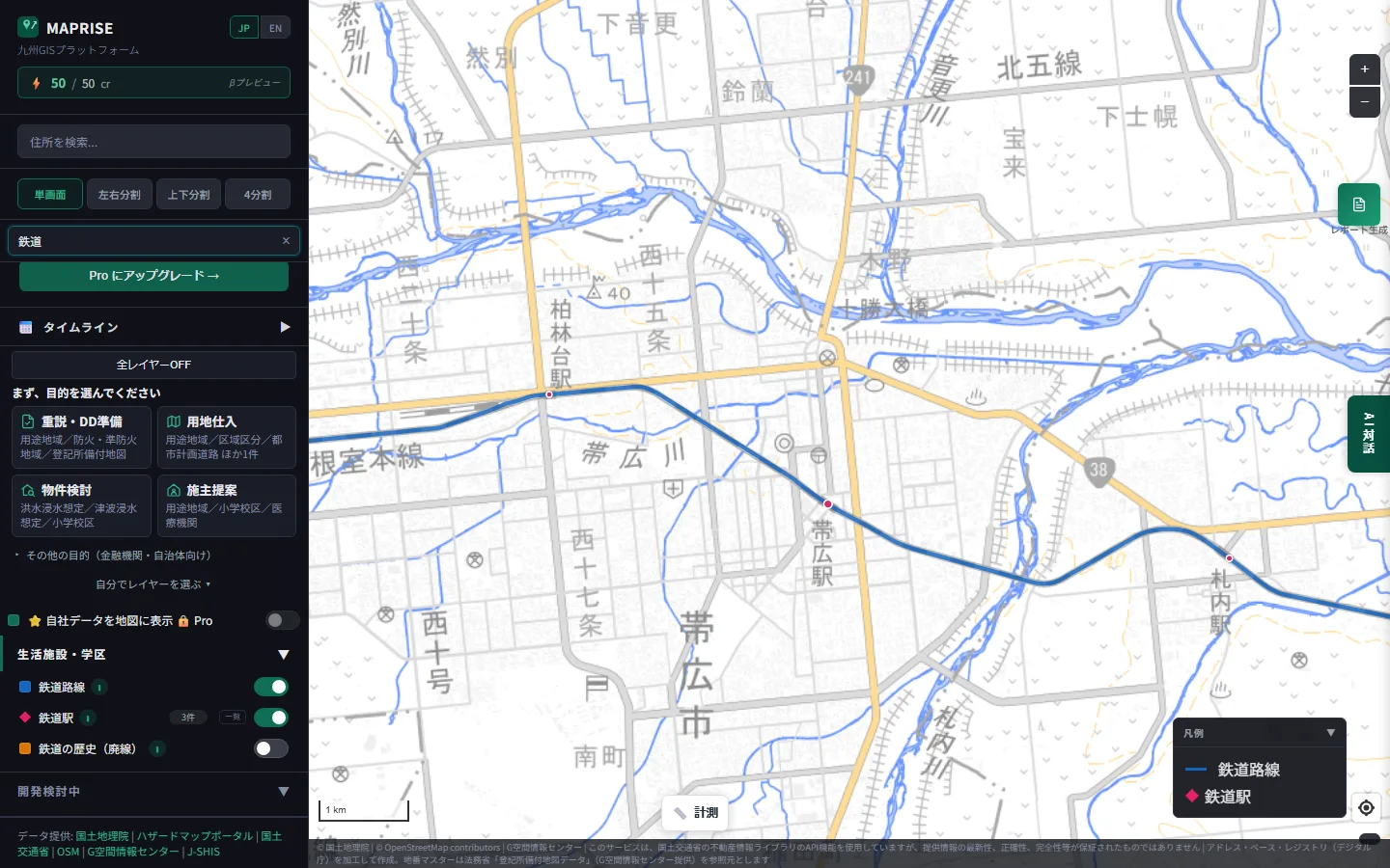
Now we overlay former stations.
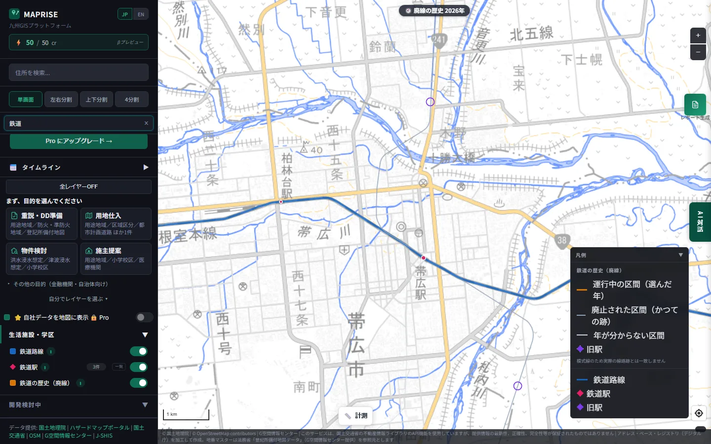
Purple former stations appear away from the current line: Kino Station to the north and Yoda Station to the southeast. There was once a station in each place. Over a wide area they appear as circles, and as diamonds when you zoom in.
What clicking tells you
Clicking a line shows its name, the years from opening to closing, and its current status.
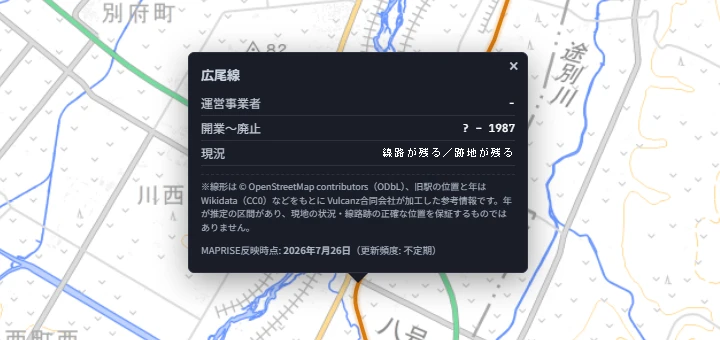
This example is the Hiroo Line, which closed in 1987. A "?" means the opening year is unknown, and "-" means no operator is recorded.
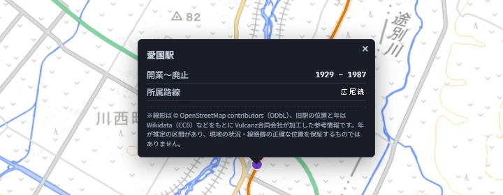
Clicking a former station shows its name, the years from opening to closing, and its line.
Hokkaido: moving the year, and the orange lines disappear
Let's move the year across the whole of Hokkaido. First, 1960.
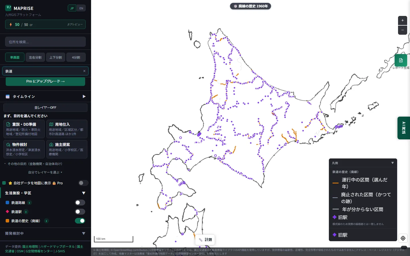
The orange lines are sections running in that year. Here is the same map set to 2026.
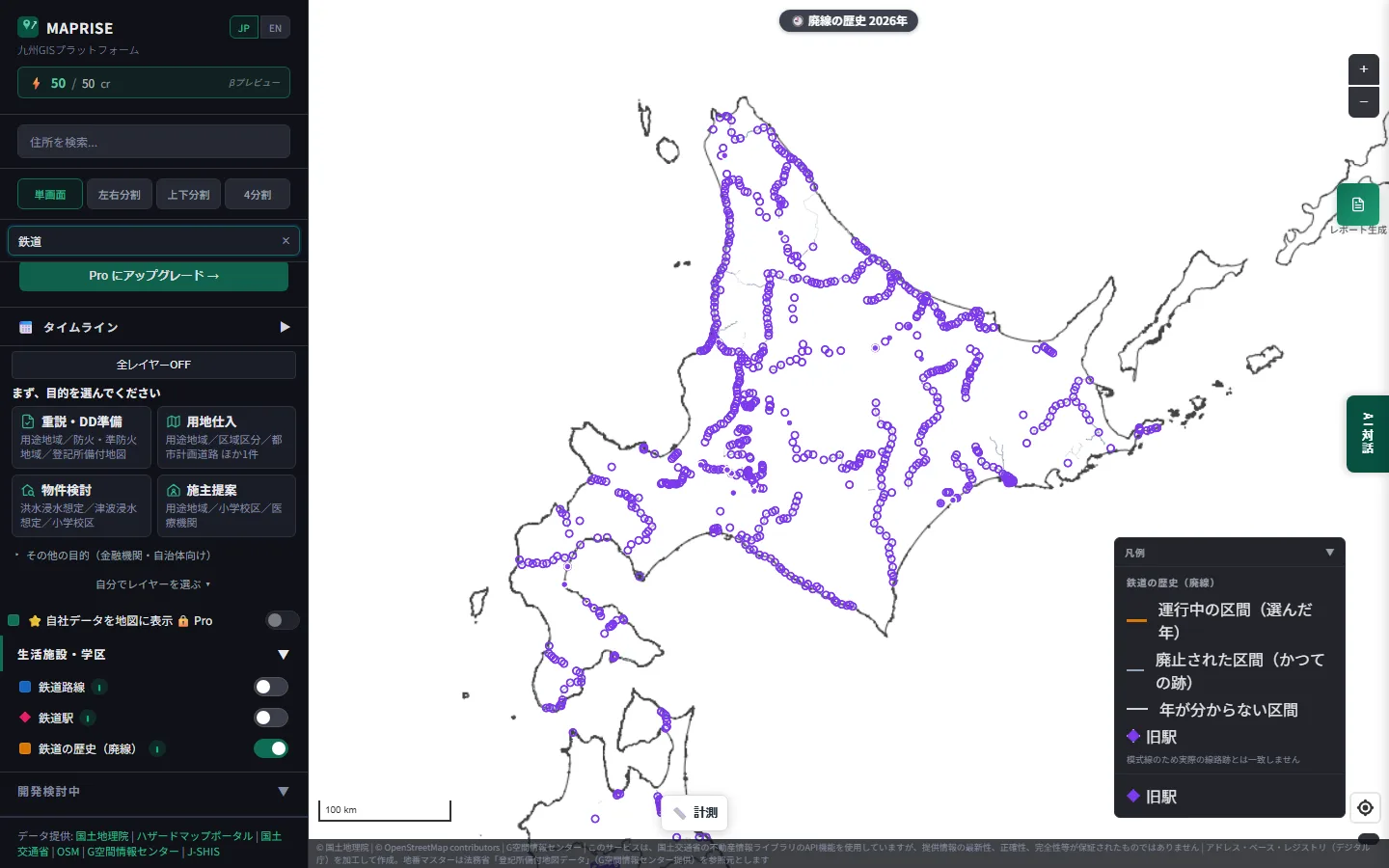
The orange lines vanish, and only the former stations remain across the island. It looks as though the memory of the railway survives only at the stations.
Hokkaido: comparing past and present along the Hiroo Line
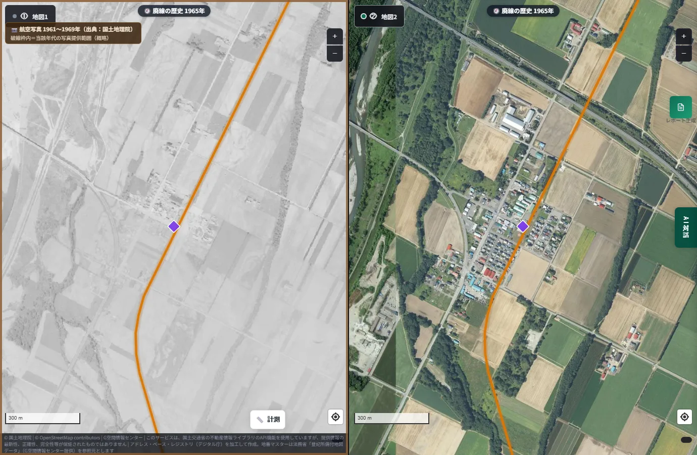
Next, let's compare past and present aerial photographs around Aikoku Station on this same Hiroo Line. Using MAPRISE's side-by-side split view, the old photo is on the left and the current photo on the right. In both, the former station and the Hiroo Line are overlaid at the same position.
First, a black-and-white aerial photograph from 1961–1969.
And a color aerial photograph from 1974–1978.
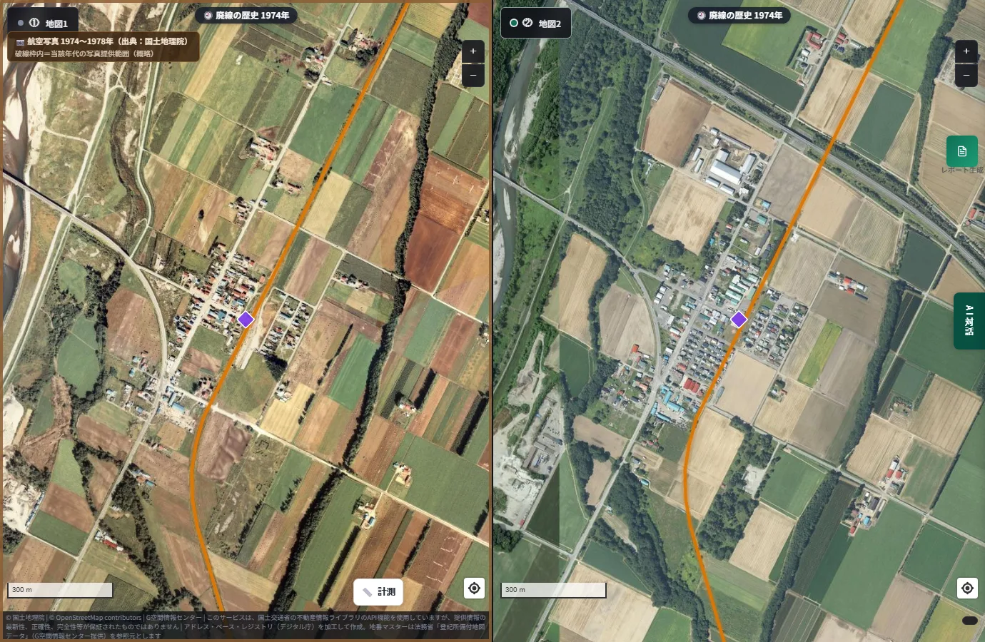
The look of what was a small settlement surrounded by fields differs by era. Buildings that once clustered along the tracks appear to have spread out around them in the current photo.
Aikoku Station is said to be preserved today as a "Transportation Memorial Hall" using the station building. Even in the zoomed-in aerial photograph, you can see what looks like garden paths around the station's position (the purple frame).
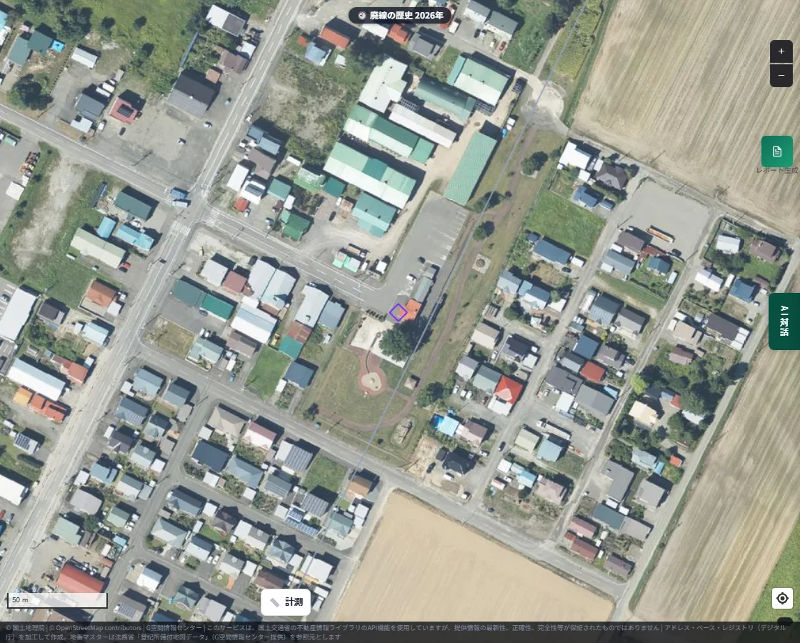
Kofuku Station, on the same Hiroo Line, has been developed into a railway park. These are examples of closed stations that live on as sightseeing and memorial sites.
Tohoku, Chugoku, Kyushu: lines from around Japan
Let's look at examples beyond Hokkaido.
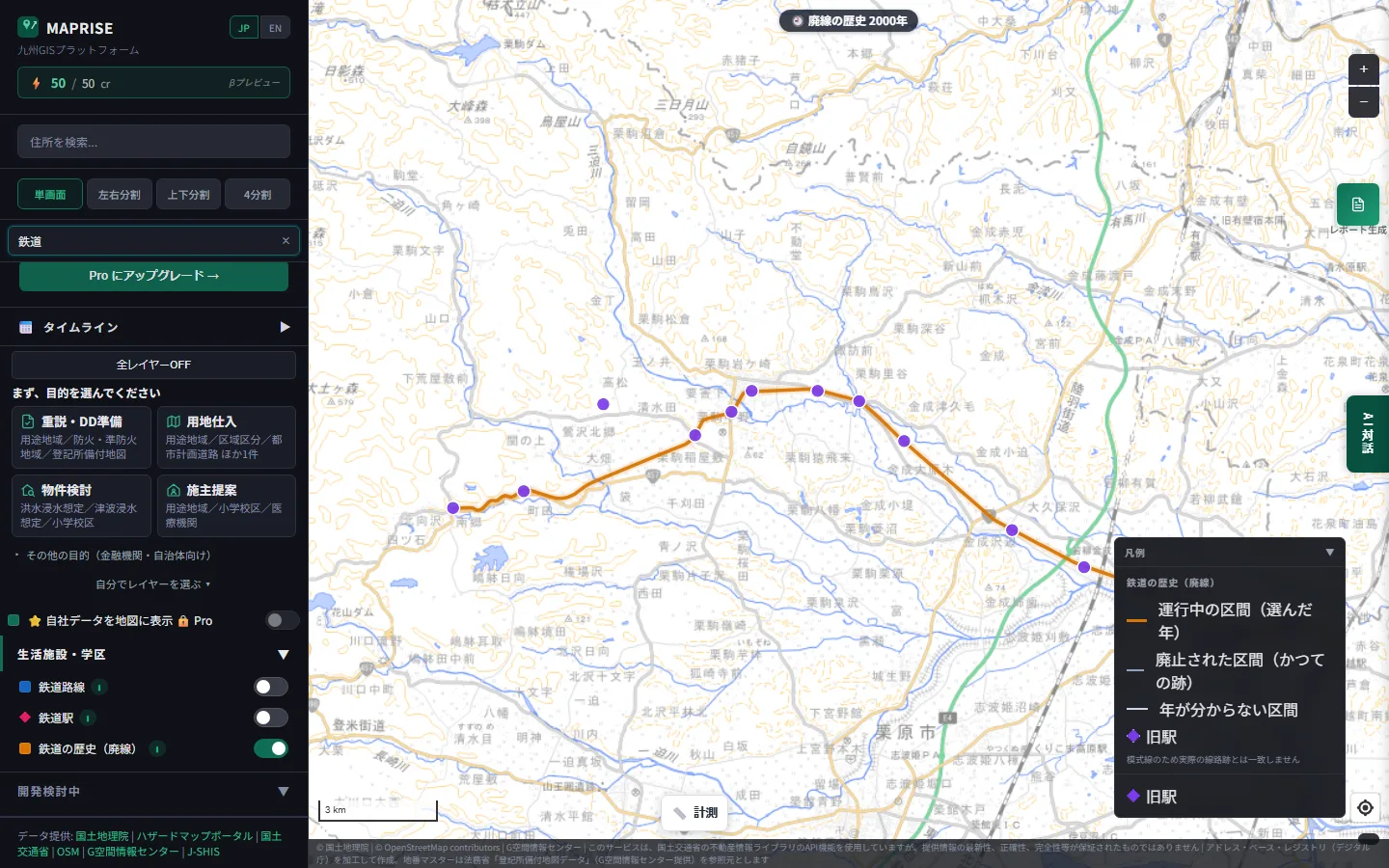
In Tohoku, the Kurihara Den'en Railway in Miyagi Prefecture closed in 2007. The map is set to 2000, when it was running.
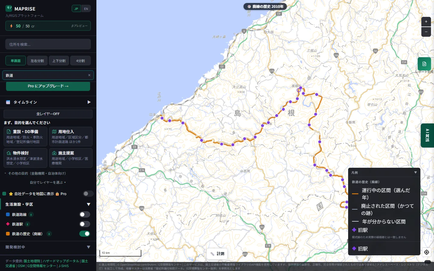
In Chugoku, the Sanko Line linked Shimane and Hiroshima prefectures and closed in 2018. The map is set to 2010.
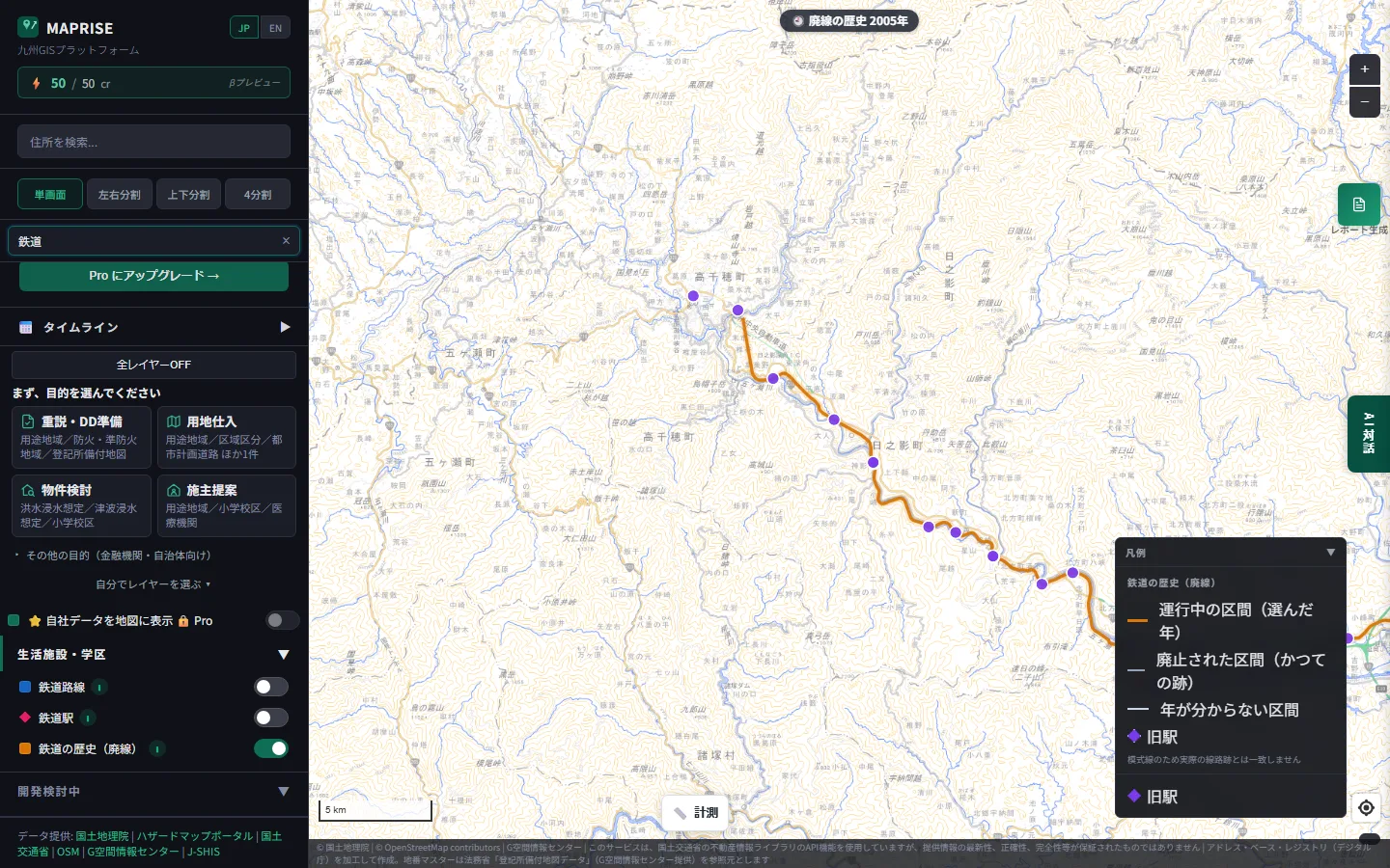
In Kyushu, the Takachiho Railway in Miyazaki Prefecture was badly damaged by a typhoon in 2005 and was closed in stages in 2007 and 2008. The map is set to 2005.
Some of these former lines have been put to new use, such as experience attractions with rail bikes and super karts.
A clue to a piece of land's past
Land that was once a railway can sometimes be long and narrow in shape, or show traces of embankments and cuttings. Realizing that what looks like an ordinary road or field today was once a railway can itself be a clue to the land's history.
We've written before about the pleasure of overlaying old and new maps to trace a town's memory. Please have a look if you like.
- Chasing the Hizen Moat sleeping beneath Tenjin, with MAPRISE's old-map layers
- Why Is There a "Suspension Bridge" in an Underground Passage in Tenjin? — An Unexpected Link to the Hizen Moat, Found with Old-Map Layers
Being upfront about the limits
- Line shapes are based on contributions to OpenStreetMap, and we don't guarantee completeness or accuracy.
- Opening and closing years include estimates. Items shown as "?" or "-" indicate missing data.
- Former track beds may now be private land or restricted areas. Please be careful when visiting in person.
Closing
Memories of the trains that once ran slowly fade. Even so, when you move the year on the map and watch orange lines turn gray, you can feel that change over time. We hope it prompts you to think about the history of the land beneath your feet, in your daily life and your work.
Questions or feedback are always welcome at info@maprise.jp.
The former-railway and former-station data introduced in this post is reference information built from OpenStreetMap contributors (ODbL 1.0) and Wikidata (CC0), among other sources, processed by Vulcanz LLC. Opening and closing years include estimates, and we do not guarantee the exact position of former track beds or the current condition on the ground. Aerial photographs are provided by the Geospatial Information Authority of Japan. The current status of Aikoku and Kofuku stations, and the history of the closures of the Takachiho Railway, Kurihara Den'en Railway, and Sanko Line, are based on publicly available information from local governments and tourism associations.
Tags: #Former railways #Former stations #Railway history #Aerial photos #Hokkaido
Other-language share text (exception cases)
Quick share above follows our platform-locked language policy (X-family in Japanese, LinkedIn in English). The four panes below let you grab the opposite-language body when needed — e.g. introducing an English post to a Japanese audience on X, or posting a Japanese article to LinkedIn in Japanese. Each pane offers both a copy button and a direct intent link.
📝 かつて鉄道が走っていた場所を地図にしました ― 廃線と旧駅が、少しずつ色を薄めていく
全国の廃線の線路跡と旧駅を、年ごとに見られる地図レイヤーとして追加しました。従来の鉄道レイヤーとの違い、旧駅のプロット、クリックで分かる情報、そして北海道から九州までの例を、過去の航空写真との比較とあわせて紹介します。
https://maprise.jp/ja/blog/former-railways/ #廃線 #旧駅
🆕 新しいブログ記事を公開しました。

《かつて鉄道が走っていた場所を地図にしました ― 廃線と旧駅が、少しずつ色を薄めていく》

全国の廃線の線路跡と旧駅を、年ごとに見られる地図レイヤーとして追加しました。従来の鉄道レイヤーとの違い、旧駅のプロット、クリックで分かる情報、そして北海道から九州までの例を、過去の航空写真との比較とあわせて紹介します。

👉 詳しくはこちら: https://maprise.jp/ja/blog/former-railways/
📝 Mapping Where Trains Used to Run — Former Railways and Stations, Slowly Fading
We've added a map layer that shows former railway lines and stations across Japan, year by year. Here's how it differs from our existing r…
https://maprise.jp/en/blog/former-railways/ #Formerrailways #Formerstations
🆕 New on the MAPRISE blog.

《Mapping Where Trains Used to Run — Former Railways and Stations, Slowly Fading》

We've added a map layer that shows former railway lines and stations across Japan, year by year. Here's how it differs from our existing railway layer, how former stations are plotted, what you see when you click, and examples from Hokkaido to Kyushu, compared with past aerial photographs.

👉 Read the full post: https://maprise.jp/en/blog/former-railways/

#Formerrailways #Formerstations #Railwayhistory #Aerialphotos #Hokkaido
Related posts
- Where Do Airplanes Actually Fly? Haneda, Narita, Kansai, Itami and Fukuoka on the Aircraft Overflight Layer2026-10-21
- How Do Airports on the Sea Look on a Map? Kansai and Centrair on the Aircraft Overflight Layer2026-10-21
- Nagasaki Station at 1 m: What a Hillside City Really Looks Like ― Colored Contour Maps Built from Nagasaki Prefecture's Point Cloud2026-10-21