MLIT's PLATEAU 3D city model leaves over 270,000 buildings across Kyushu with no recorded use — even landmarks like Canal City Hakata. Here's how we combined external data sources to fill in the use classification for 471 of them.
Hi, this is the MAPRISE dev team. We wrote earlier about how to use the PLATEAU Buildings layer; this time it's a different kind of report — how we reworked PLATEAU's data rather than just displaying it as-is.
Canal City Hakata, shown as "unknown" on the map
On July 11, while testing and reviewing the use-based color coding on our PLATEAU Buildings layer, we noticed something odd: Canal City Hakata — one of Fukuoka's best-known mixed-use complexes (roughly 20,300 sqm of floor area, 63.5m tall) — wasn't shown as residential or commercial. It was grey: "unknown / other."
To be clear, this isn't a flaw in PLATEAU's data. Surveying the exact use of every single building nationwide simply isn't realistic for a project operating at this scale, and an honest "unknown" label is the right call when that data isn't available. In fact, across our 17 Kyushu cities and roughly 1.55 million buildings, an estimated 270,000 or so (per our own tally) have no recorded or unknown use. If anything, the fact that a dataset of this scale is maintained and released for free at all is a huge asset for urban DX.
But from where we sit — building a map product on top of this data — it's a different story. If the first thing a user notices when opening the map is a famous landmark rendered as "unknown," that's a product problem we can't ignore.
We stopped just displaying PLATEAU as-is
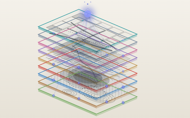
Most GIS products display PLATEAU's data as-is, and there's nothing wrong with that approach on its own. We decided to go a step further: fill in what PLATEAU alone can't tell you, by combining it with other data.
Concretely, we cross-referenced several external data sources — map data, public facility data, statistical data — through our own logic, with some AI-assisted analysis in the mix, to identify the actual use of buildings currently shown as "unknown," one building at a time. We're keeping the exact processing pipeline under wraps here, but the short version: we prioritized roughly 770 "unknown" buildings across Kyushu with a footprint of 2,000 sqm or more (i.e., large enough to stand out on the map), and so far we've identified and corrected the use of 471 of them — about 61%.
Some examples of what got corrected
Here's a sample of buildings we corrected. All of these used to render grey ("unknown / other") and now carry their proper use classification.
| Building | Location | Scale (floor area equiv.) | Corrected use |
|---|---|---|---|
| Canal City Hakata | Hakata-ku, Fukuoka City | ~20,300 sqm | Mixed-use commercial complex |
| LaLaport Fukuoka (main building) | Higashi-ku, Fukuoka City | ~31,400 sqm | Commercial |
| Bridgestone Tosu Plant | Tosu City, Saga | ~80,800 sqm | Factory |
| Aqua Dome Kumamoto | Kumamoto City | ~15,900 sqm | Education / welfare facility |
| AEON Town Kurosaki | Kitakyushu City | ~15,800 sqm | Commercial |
| Kumamoto Prison | Kumamoto City | ~9,200 sqm | Government facility |
| National Hospital Organization Kumamoto Medical Center | Kumamoto City | ~9,000 sqm | Education / welfare facility |
| J-Power Matsuura Thermal Power Station | Matsuura City, Nagasaki | ~10,900 sqm | Utility / infrastructure facility |
| A major pharmaceutical distributor's large distribution center | Kitakyushu City | ~26,900 sqm | Transport / warehouse facility |
From major commercial landmarks to factories, power plants, and government facilities — a wide range of "grey buildings" now have their correct color.
What it looks like on the map
On the map itself, buildings we've individually verified and corrected are visually set apart from the rest with a gold outline. Here's an example from around Gion and Sumiyoshi Shrine in Hakata.
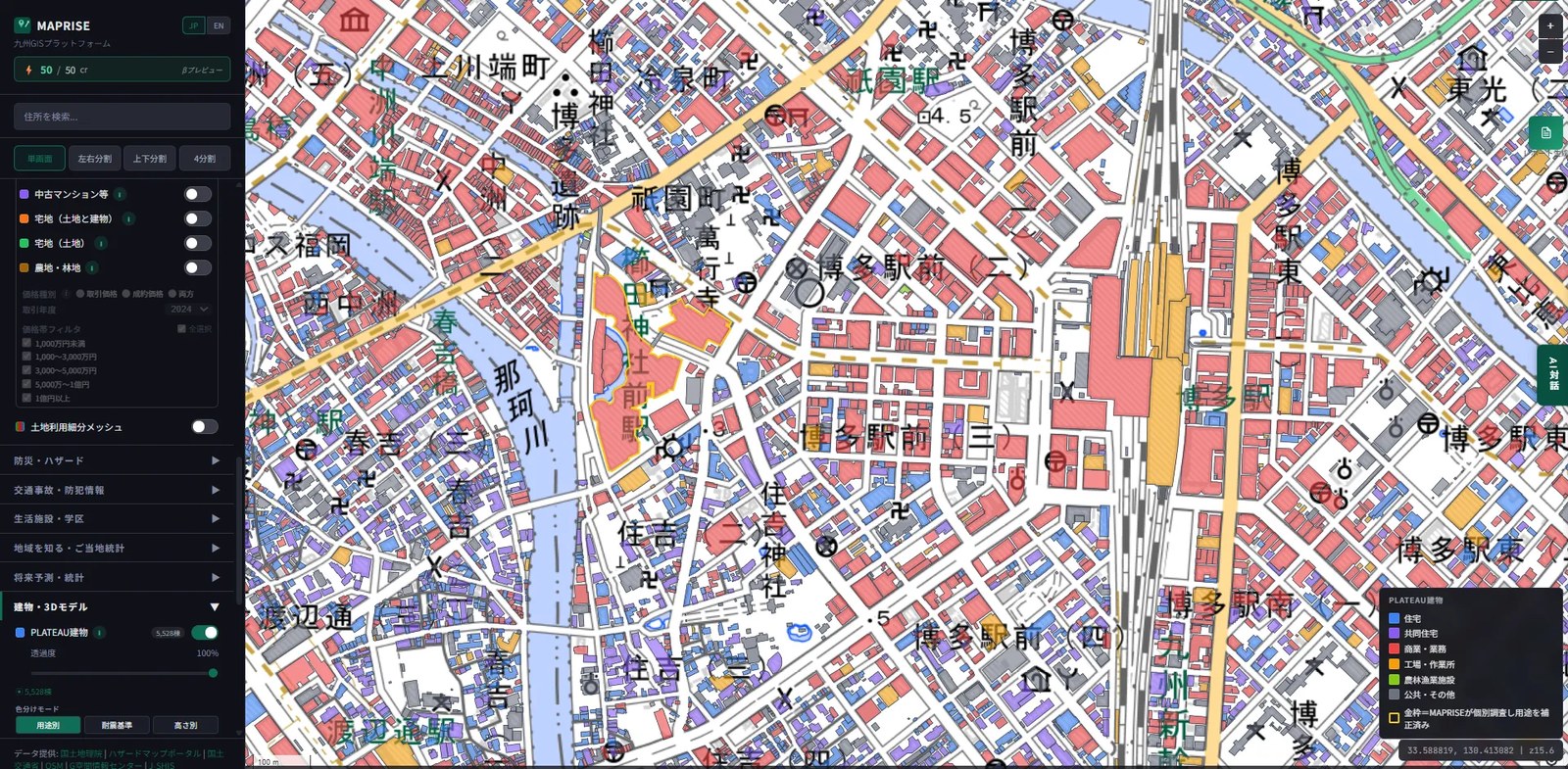
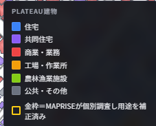
Click on a gold-outlined building and the popup shows an "individually verified" badge. From a user's perspective, it's immediately clear that this particular data point has been hand-checked by MAPRISE, not just passed through unmodified.
None of this works without PLATEAU as the foundation
We want to be clear about scope here: what we're doing is layering a limited amount of additional information on top of PLATEAU's already solid foundation. Being able to use building-level position, height, and structural data across 17 Kyushu cities and roughly 1.55 million buildings — for free — simply isn't possible without Project PLATEAU's data maintenance and release. What we've corrected so far is a small slice of that (471 out of 770 priority candidates), and the vast majority of buildings with unknown use are still just that: unknown.
Even so, we think this kind of work — not just consuming open data as-is, but combining it with other sources to make it more usable — is exactly the kind of private-sector application and enhancement that Project PLATEAU has been encouraging. If anyone from MLIT or the Project PLATEAU team happens to come across this post, we'd genuinely welcome the chance to talk about what we've built.
One more note on timing: the PLATEAU data referenced in this post is a snapshot as of June 2026, and our use corrections are applied against that snapshot. MLIT's own data maintenance will likely keep improving over time, and the buildings themselves keep changing too — new construction, demolition, changes of use. Please read this post with that in mind: none of this is fixed in place.
We'll keep chipping away at the remaining buildings and report back on progress here.
The use classifications described in this post are the result of our own analysis combining multiple external data sources, and are not official survey or registry-based determinations. If you need accurate information about a specific building's use, please consult primary sources such as your local municipality or registry records. The underlying PLATEAU building data itself is sourced from the 3D city model maintained by Japan's Ministry of Land, Infrastructure, Transport and Tourism (MLIT) (licensed under CC BY 4.0).
Tags: #PLATEAU #3D city model #MLIT #Open data #Case study
Other-language share text (exception cases)
Quick share above follows our platform-locked language policy (X-family in Japanese, LinkedIn in English). The four panes below let you grab the opposite-language body when needed — e.g. introducing an English post to a Japanese audience on X, or posting a Japanese article to LinkedIn in Japanese. Each pane offers both a copy button and a direct intent link.
📝 PLATEAUの「用途不明」建物データを補完する ― キャナルシティが灰色だった理由
国土交通省PLATEAUの3D都市モデルには、用途が「不明」のまま登録された建物が九州だけで27万棟以上あります。キャナルシティ博多も例外ではありませんでした。外部データと組み合わせて471棟の用途を補完した取り組みをご紹介します。
https://maprise.jp/ja/blog/plateau-usage-data-enrichment/ #PLATEAU #3D都市モデル
🆕 新しいブログ記事を公開しました。

《PLATEAUの「用途不明」建物データを補完する ― キャナルシティが灰色だった理由》

国土交通省PLATEAUの3D都市モデルには、用途が「不明」のまま登録された建物が九州だけで27万棟以上あります。キャナルシティ博多も例外ではありませんでした。外部データと組み合わせて471棟の用途を補完した取り組みをご紹介します。

👉 詳しくはこちら: https://maprise.jp/ja/blog/plateau-usage-data-enrichment/

#PLATEAU
📝 Filling in PLATEAU's "unknown use" buildings — why Canal City showed up grey
MLIT's PLATEAU 3D city model leaves over 270,000 buildings across Kyushu with no recorded use — even landmarks like Canal City Hakata. Here's how we c…
https://maprise.jp/en/blog/plateau-usage-data-enrichment/ #PLATEAU #3Dcitymodel
🆕 New on the MAPRISE blog.

《Filling in PLATEAU's "unknown use" buildings — why Canal City showed up grey》

MLIT's PLATEAU 3D city model leaves over 270,000 buildings across Kyushu with no recorded use — even landmarks like Canal City Hakata. Here's how we combined external data sources to fill in the use classification for 471 of them.

👉 Read the full post: https://maprise.jp/en/blog/plateau-usage-data-enrichment/

#PLATEAU #3Dcitymodel #MLIT #Opendata #Casestudy